Woke up early around 6:30am, took a sunrise shot of the St. Lawrence and quickly went back to sleep because breakfast starts at 8am. Today we decided to head out to Gaspésie National Park, ride us some dirt roads and hike us some mountains.
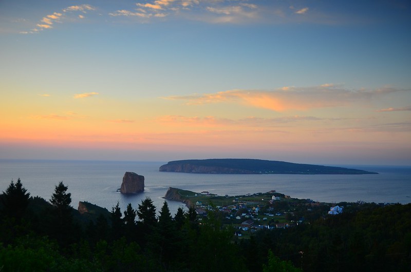
Sunrise over the gulf
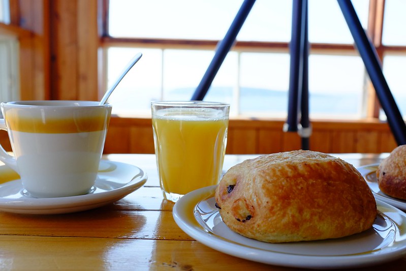
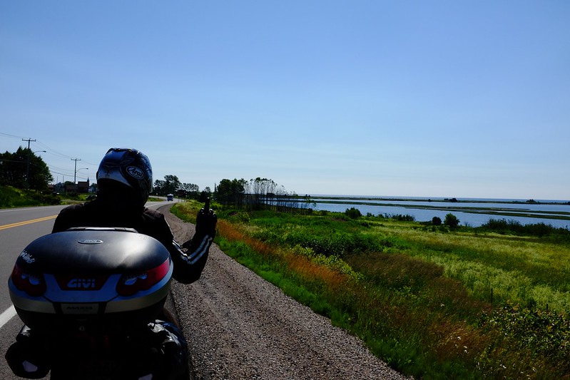
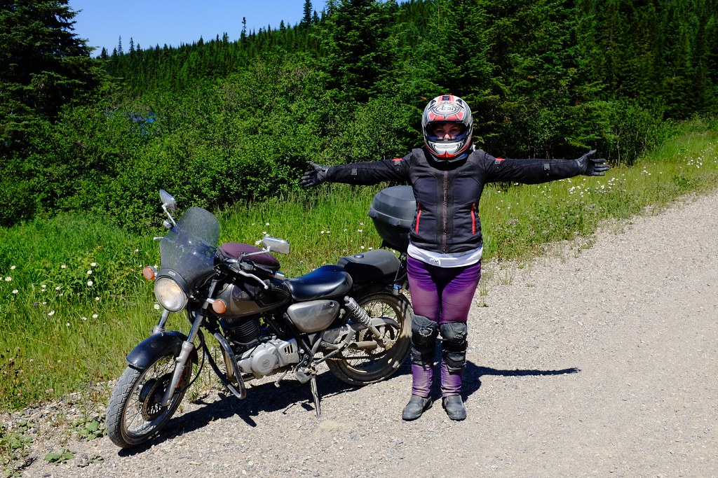
We had our usual breakfast and headed down to the bakery for some extra pastries for the road. We got a bottle of water as well (physical need for water will be a big theme today) and continued on our way by highway 132 to 198 to the town of Murdochville. This town was at the center of a valley of small mountains with what appeared to be lots of mining. Route 198 was quite scenic but we constantly got construction gravel patches.
After Murdochville we turned onto Route du Lac-Sainte-Anne, which was a gravel road and this is where we started to have fun and the mountains around us became all the more scenic. The road continued for a full 50km and after a while it became less difficult and we reached 90-100 km/h on it and met several ATVs along the way. Over time we overcame the challenge of riding side-by-side, but not before my jacket and bike and everything else got covered in dust.
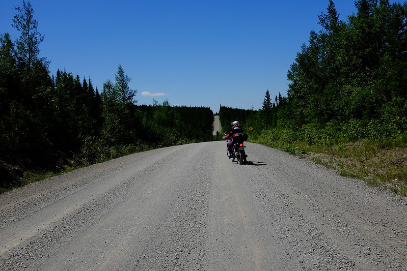
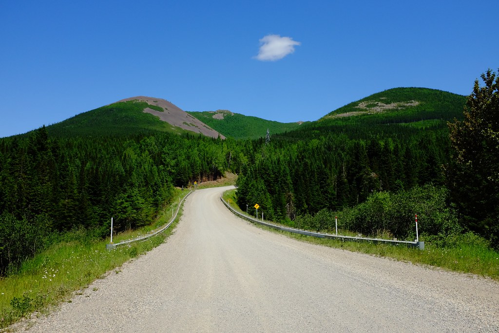
Turned onto 299, which passes right through Gaspésie National Park, and tried to find the Discovery Center. Twice turned on the wrong road, one of them was the road we eventually had to take to go for our hike. It was a gravel road and continued for many kilometers. At the Discovery Center we paid park fees and got a map along with suggestions of hikes to take. We ignored the suggestions and decided to do a more difficult climb with our limited daylight, in exchange hoping to get more thrilling views from 1140m elevation. The gravel road leading towards the trail was much harder than the one we took earlier that day with a lot of very bumpy sections where I almost lost the bike several times. (Oops, where is my bike? Oh, here it is!)
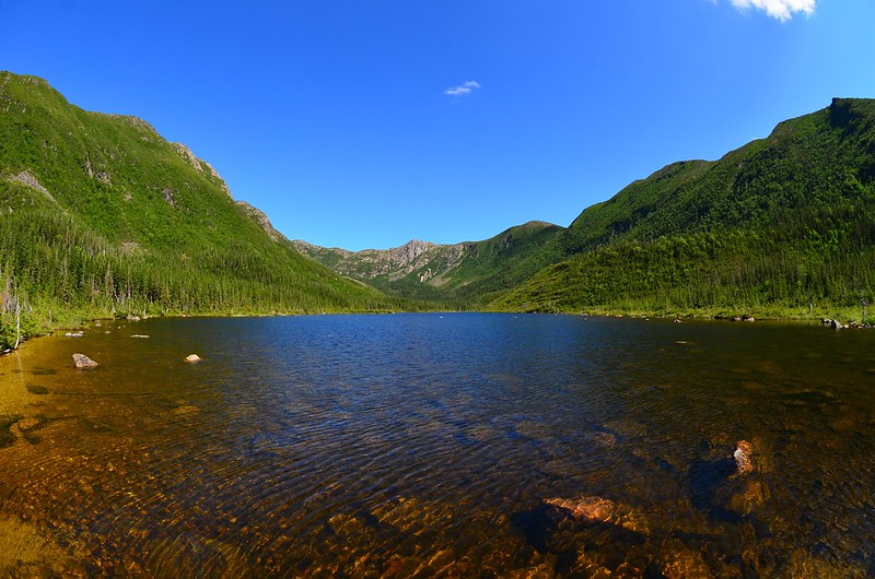
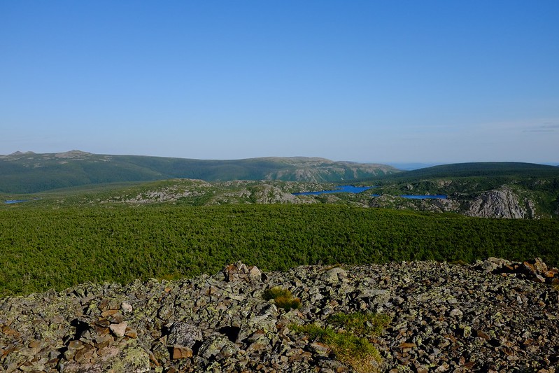
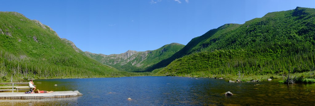
Lac aux Américains
The hike to Mount Xalibu is split into two sections. The first one is fairly short and easy, and opens up to beautiful view of Lac aux Américains. Enjoyed the view for a while, took pictures and ate some of our pastries. At this point we had about half a liter of water left. Then we began the ascent which was supposed to take a further 4 km. During this hike the mountain climbs 540 m for a total of 1140m above sea level at the summit. The hike included a lot of steep, rocky terrain. It was exhausting and hot and we did not have much water left. Beat up our BMW Allround boots pretty well, but they handled it with grace and kept our feet safe.
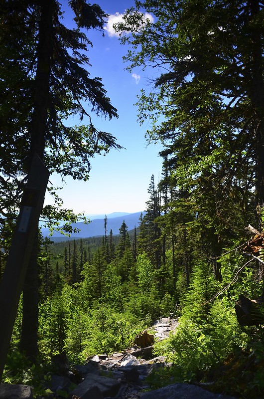
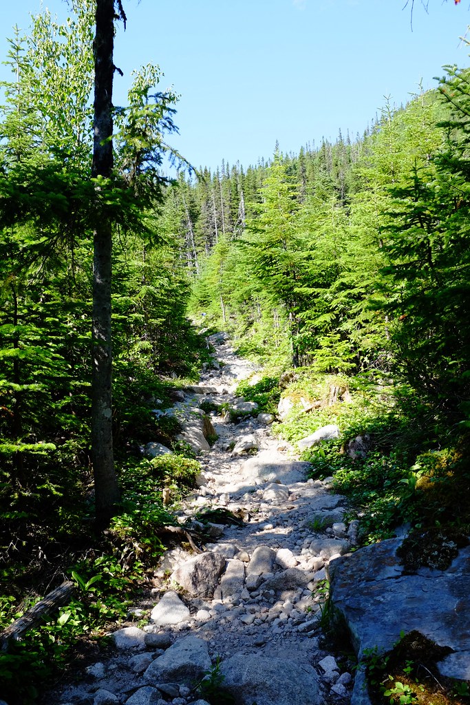
The little patch of rocks seen in lower centre is the actual trail.
Less than a kilometer away from the lake we came upon a mountain stream with icy clear water. I drank some of it while Alex was cautious and only used it to wash his face. From there on it was getting harder and harder primarily because there was no water left to drink, but also because the terrain was actually quite difficult, especially with no hiking poles or any other special equipment. With many stops it took us over two hours to climb those 4 km. At around 900m elevation the trees stop growing and only the shrubs remain, and for the final few hundred horizontal meters even the shrubs disappeared leaving just a bare rocky summit.
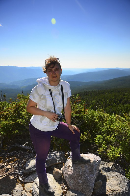
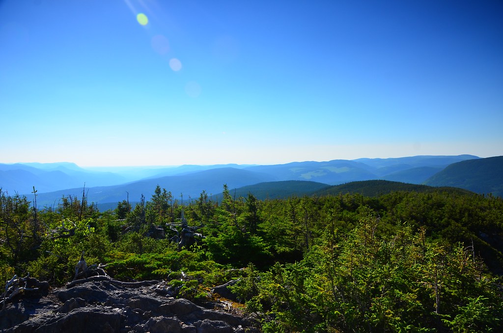
Elevation 950m, way above tree line.
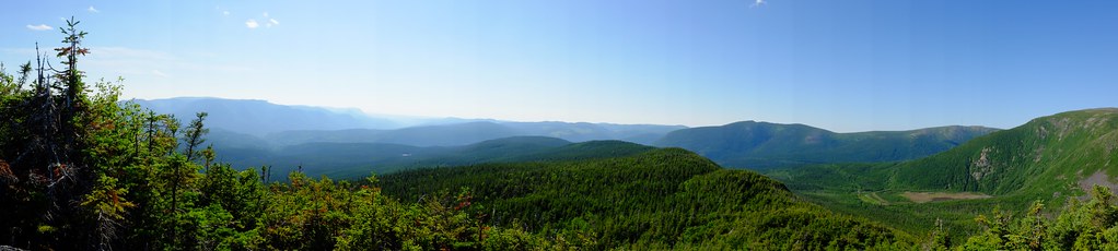
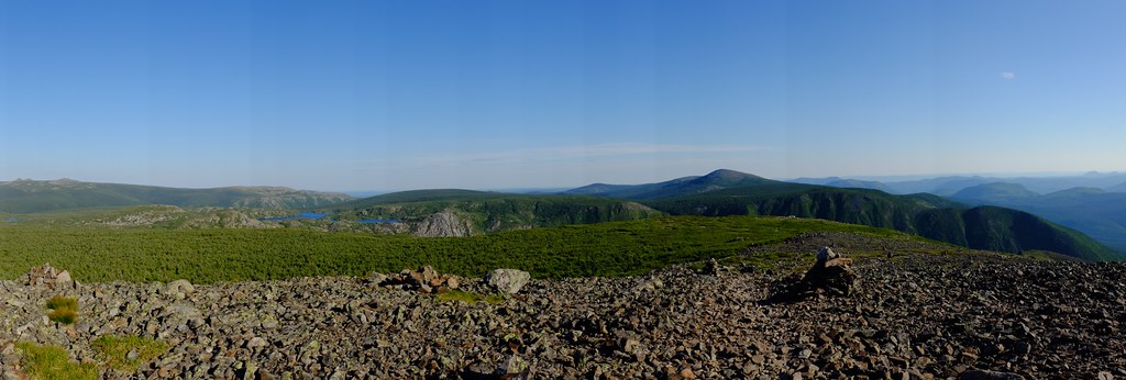
The views were indeed amazing not only at the very top but along the way as well. The trail overlooks the valley and you could see many more high peaks just like it. You could also see some mountain lakes and even a waterfall. At the top you have a 360° view of the Chic-Choc mountain range. It was very beautiful and very calming after the difficult climb. However we were thirsty and the nearest spot where you could buy refreshments would be the Discovery Center which closes at 8 o’clock and we would probably just barely make it in time if we get going soon.
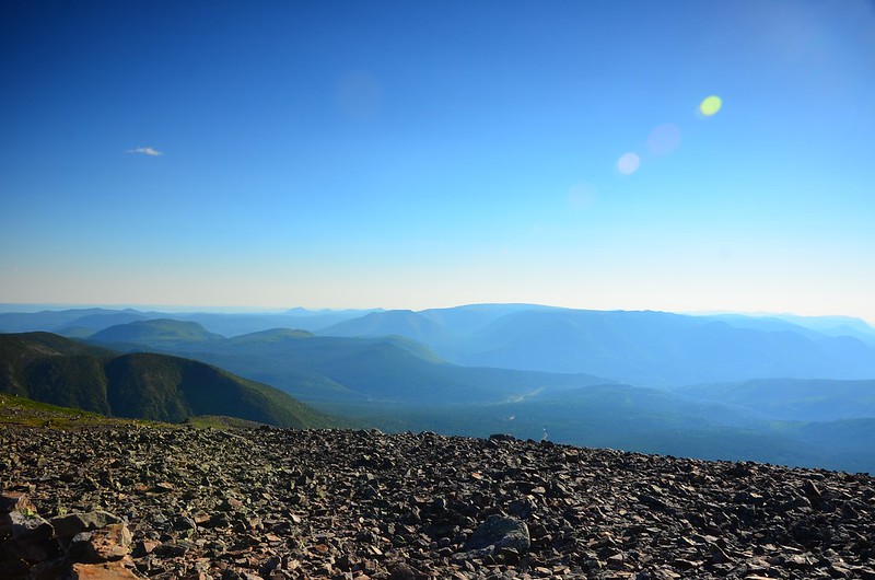
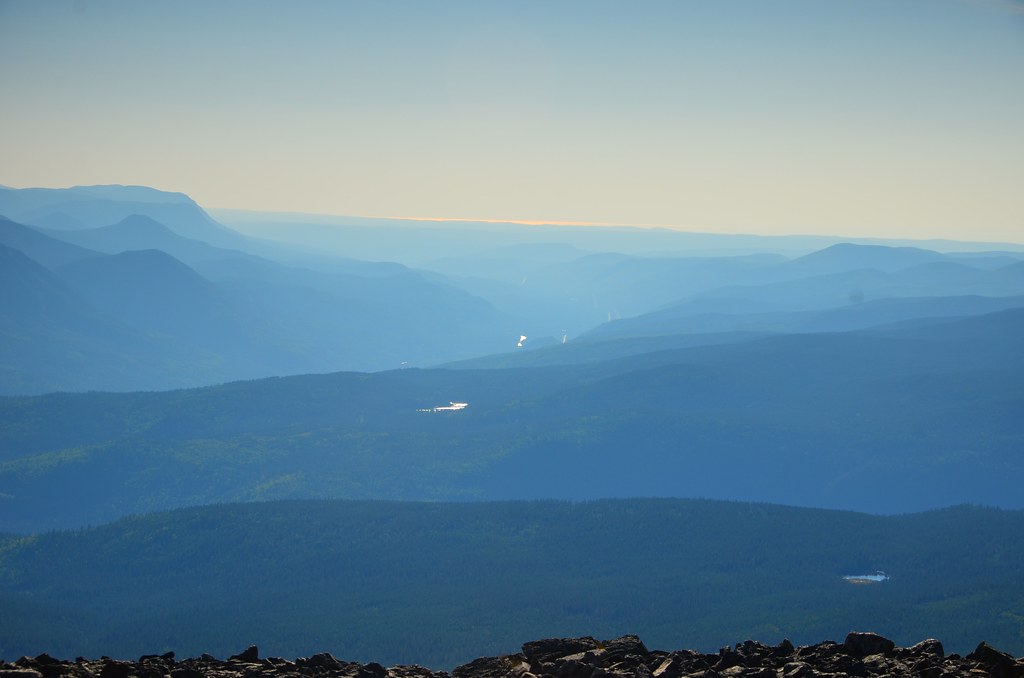
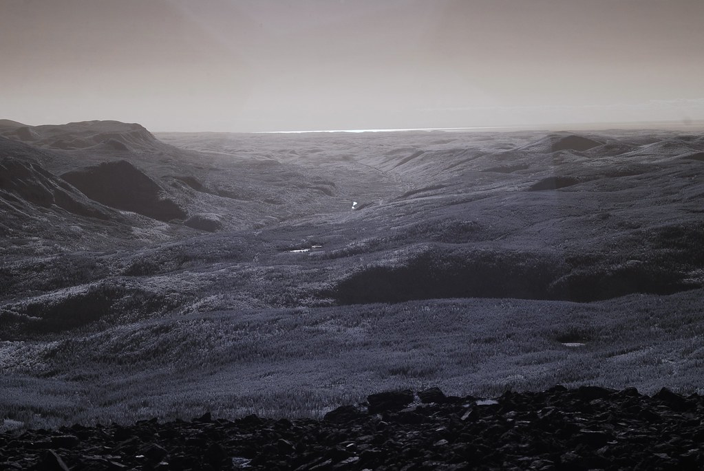
View from the summit
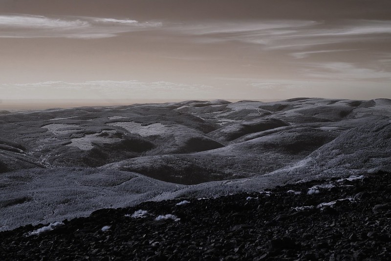
View from the summit in IR
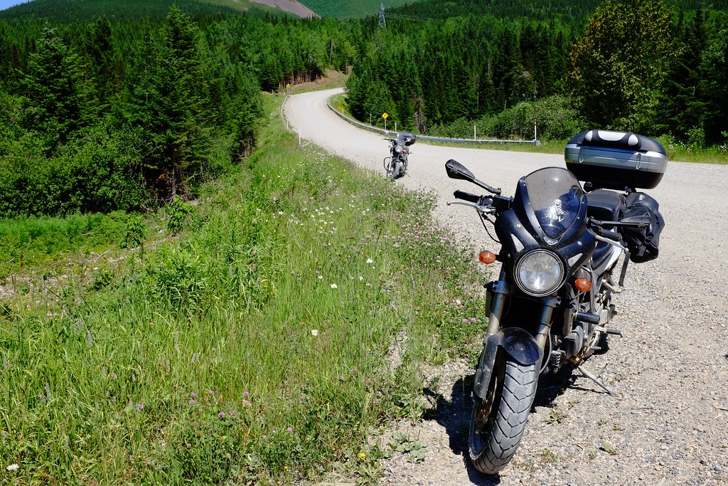
We spent about 20 minutes at the summit resting and enjoying the view. The descent was a lot easier but still quite tricky with all the rocks and odd terrain. We stopped at the stream again and refilled the water bottle and drank it just in case we did not make it to the Discovery Center. The water turned out just fine – after two days there are no signs of any sickness or anything else like that. It took us just over an hour to get down to the lake which was 1.3 km away from the parking lot. The sun was already setting and the gravel roads did not seem as bad as on the way in perhaps just different sections are better than others.
It was very beautiful riding into the sunset with a purple light covering the mountains and the sky behind them and also lighting up the dust that Alex’s bike was spitting out. I was too tired to stop to take a photo of that majestic view, but will always keep it in my mind’s eye. We made it to the Discovery Center on time and bought some Gatorade, geared up and headed back to Percé. Alex really wanted to take the gravel road back which I was quite against. After five minutes it became noticeably colder, we stopped to put our rain gear on for some added wind protection and at that point Alex realized that the gravel road is not a good idea in the dark in the middle of a forest. You don’t want to test your breaks on loose surfaces trying to avoid a moose. So we headed south on 299. The sun was setting quickly and was soon gone, leaving us in the darkness and surrounded by swarms of bugs. The flying insects were infatuated with our visors and within half an hour we couldn’t see beyond the murky bike headlights. I was thinking of stopping, thinking that maybe I could find a rag somewhere in my topcase that could help me clean this madness off my visor so that I can stop riding blind, but I shuttered at the thought of being still and preyed upon by a thousand mosquitos.
Luckily by the time we reached the nearest town almost 100 km further there were still gas stations open at almost 10pm. Something tells me that if this was rural New Brunswick or Nova Scotia, we would be stuck there with no gas, as I was running on my last reserves by this point. Fueled up and with some more drinks we headed for another hour and a half long stretch towards Percé. Amazingly, highway 132 is actually lit up almost continuously along the shore at night. We were no longer bombarded by bugs and were not in total darkness. We were slightly hungry but did not want to stop at silly fast food joints. We were hoping that maybe grocery store or restaurant or at least a bar at the end of the town would still be open for some decent food. We came in close to midnight and lucked out on dinner. Better luck in the morning 😉


No Comments »
No comments yet.