View from Whiteface Mountain
The last morning of our trip started rather lazily. We did not have any immediate plans and did not really do much research about the Lake Placid area, aside from knowing that it’s nestled in the middle of Adirondacks so it should be pretty when served the right way. We started out by slowly riding through the town in search of a good breakfast.
The slow ride was necessitated not as much by our desire to scout local food joints, but by the heavy tourist traffic of the village. The day was beautiful, everyone was try to go somewhere, nobody was going very far. We stopped at a cafe that served several dozens kinds of crepes and sandwiches. It took a while to decide which of the 100+ items on the menu we would like to have, but it took even longer to wait in line to finally place the order. Despite the long wait, the food was on par with what you would find in decent Québec creperies, so it was quite worth it.
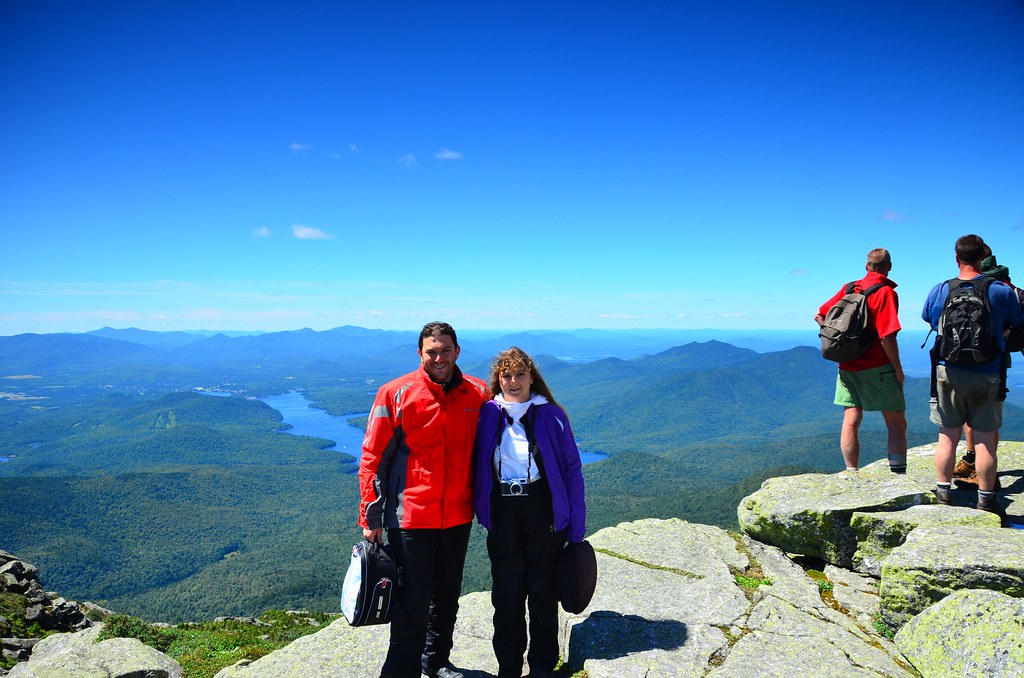
There are many beautiful places to visit in the Adirondacks, but the most prominent attraction seemed to be the Whiteface Mountain, so we decided to check it out and hopefully have a clear panoramic summit view this time around. The weather forecast was sunny, so that was in our favour.
The road leading to the mountain was picturesque and studded with numerous lakes. Route 431, which leads almost all the way to the summit was uncharacteristically straight for a mountain road, except for a couple of hairpin turns close to the top. Mount Washington road on the other hand had too many hairpin turns to count.
There is a toll booth at the mountain’s base, at the start of the Veteran’s Memorial Highway, which is responsible for a bit of congestion trying to go up. While waiting to get in we noticed that although the weather at the base was warm and sunny, the summit promised to be much cooler and windier. A couple of riders ahead of us stopped right after the toll booth and were putting on more clothes. We followed their lead and brought out our rain jackets to keep the wind at bay.
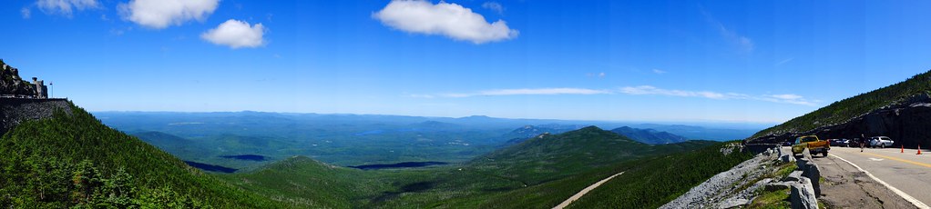
Panoramic view from the top of the Whiteface Mountain
There were great views along the way and even a few places to stop on the side of the road – complete with picnic tables. At the end of the paved road we took the hike up to the actual summit. There is an elevator to take you there with less struggle, but it was not working at the time, so the only way up was by foot. The hike started off as just walking up a staircase, but soon turned into a rock covered mountain trail, with metal guardrails running along the ridge. Many of the large rocks were very slippery, having been smoothed out by thousands of footsteps over the years. There was definitely more traffic here than at Mount Xalibu in Gaspésie National Park.

The path to the mountain elevator, not operational.
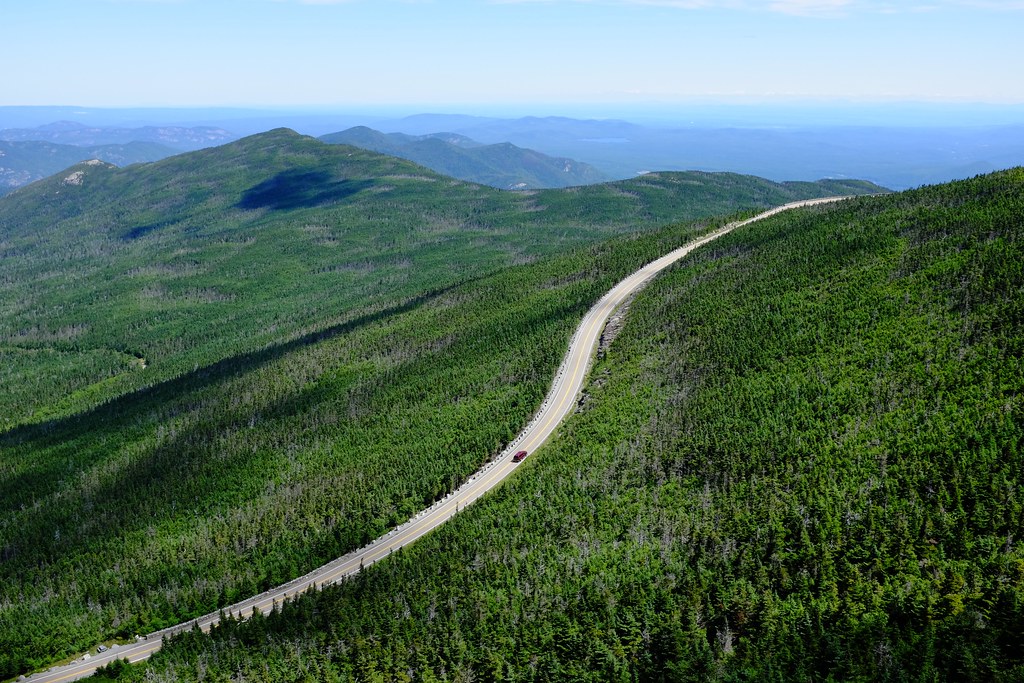
Veteran’s Memorial Highway snaking through the Adirondacks.
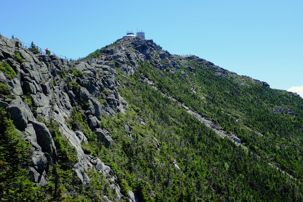
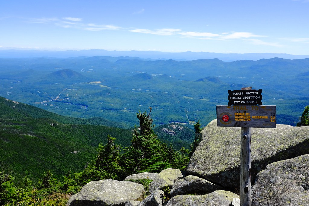
The path to the summit is on a narrow ridge, flanked by steep slopes on either side. The steep angles make this area very fragile and susceptible to landslides when combined with excessive rain. The exposed rock trails seen in the photo are the signs of such landslides. Some notable ones occurred after heavy rainfalls in 1971 and 2011, and by all indications, there will be more in the future.
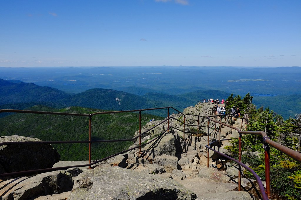
Trail to the summit is surrounded by unobstructed views of the Adirondack mountains, valleys, and lakes.
Once past the tree line, Lake Placid dominates the view from Whiteface Mountain. On a beautiful day like today the summit is filled with people enjoying the spectacular vistas. It’s quite spacious up here, with lots of room to sit on the rocks in the sun and look meditatively into the distance. As busy as it seems, this is definitely a place where one can sit for hours relaxing and embracing the landscape.
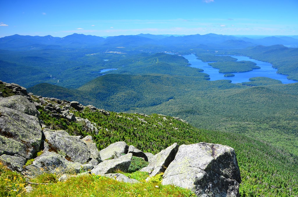
Prime view of the lake from the very top of the mountain
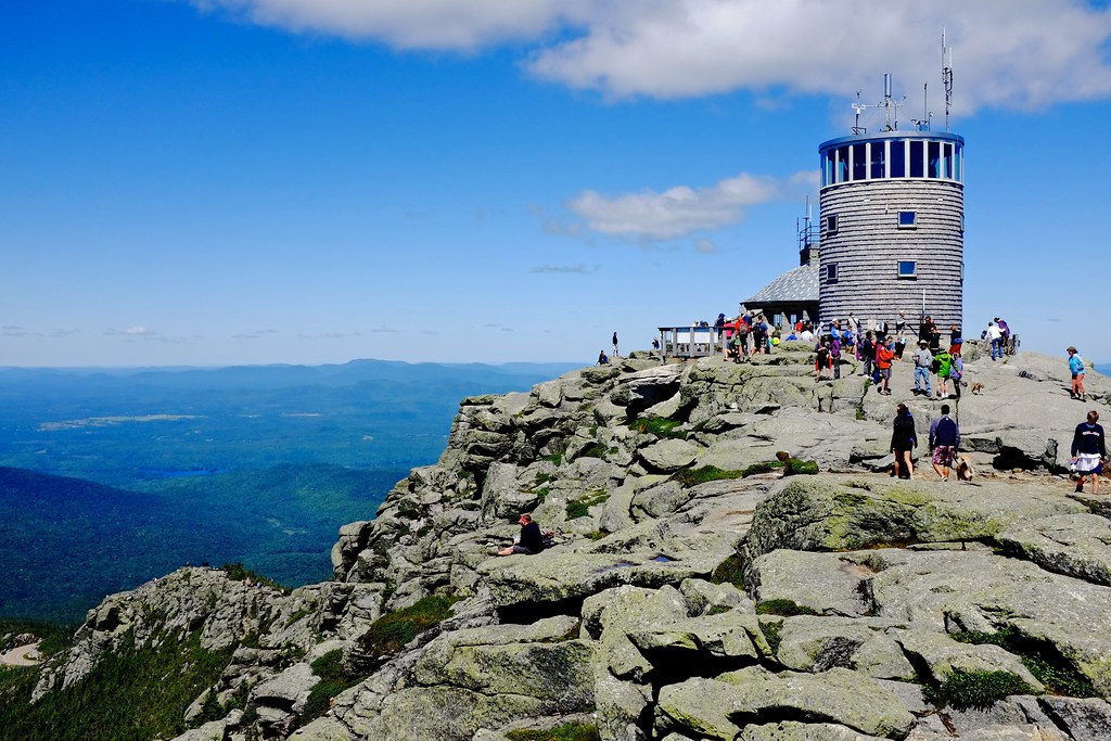
Walking around the summit you can read up some interesting things about the ancient history of this mountain range. Geologically, Adirondacks are related to the Laurentian mountains in Canada, not the nearby Appalachian range. Newfoundland’s Long Range Mountains on the other hand, are part of the Appalachians. Mountains know no political borders ;). More curiously, during the last ice age the valley was under a 2 mile thick layer of ice, so heavy it caused it to sink below sea level. As the ice retreated, the sea water flooded the valley and turned it into a part of the Atlantic ocean for over 1000 years, complete with at least 5 species of whales and other sea creatures. Their fossils are commonly found by the archeologists. That explains the whale tale sculpture we saw as we crossed Lake Champlain Bridge!
Before heading back we made a short stop at one of the picnic areas and had a small snack. The peaceful lunch was interrupted by a funny guy in a passing car, who stuck his head out and shouted “VStrom rulez!” in our direction before disappearing in a corner. People like that present a choking hazard!
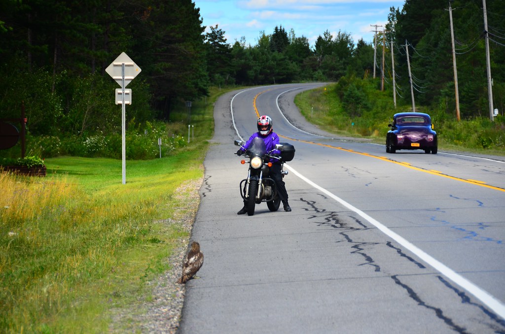
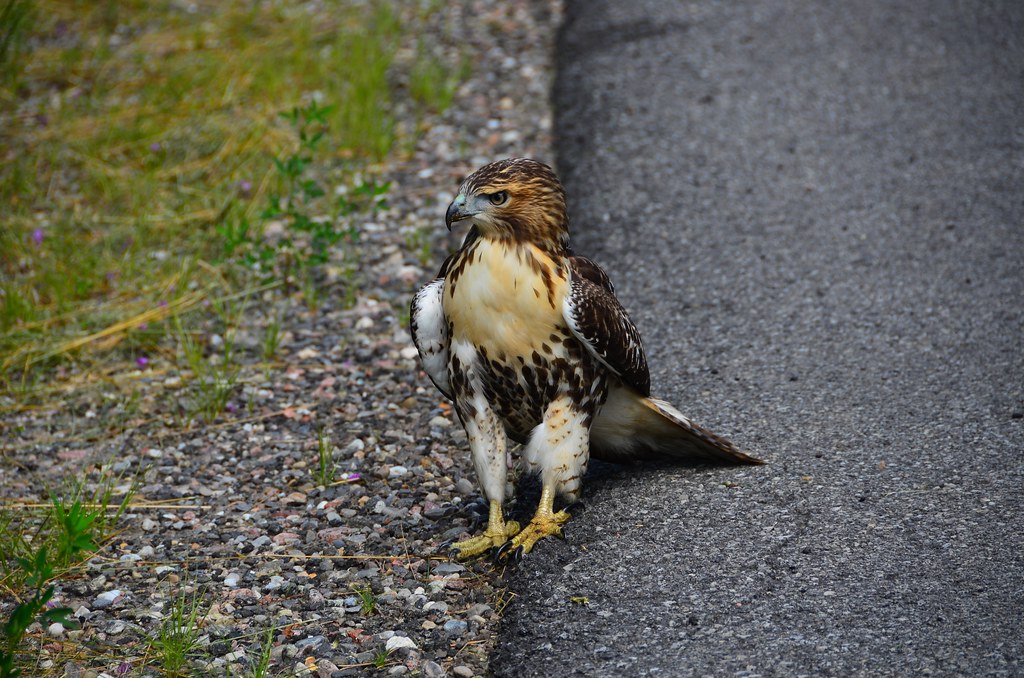
Following a series of country roads we were going further west and north. We couldn’t help noticing that the landscape looked more and more like Ontario. One interesting distraction was provided by a red tailed hawk that sat by the side of the road and did not seem to care at all when we approached to take photos. He eventually moved a little closer to the trees and bushes away from the road, found something to snack on, got bored and finally flew into the woods.

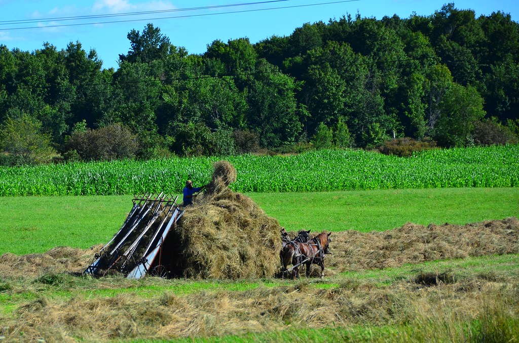
Amish baling hay, near route 26.
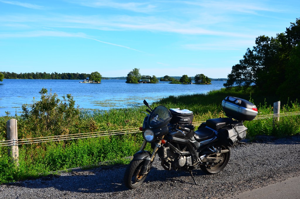
Eventually we made it to the border crossing near 1000 Islands. The border officer was of the less friendly variety and asked us to recite our plate numbers and warned us to come in one at a time next time. Instead of going directly for the 401, we took the 1000 Islands Parkway to be able to stop for photos in this scenic part of the route.

Making some Canadian honey
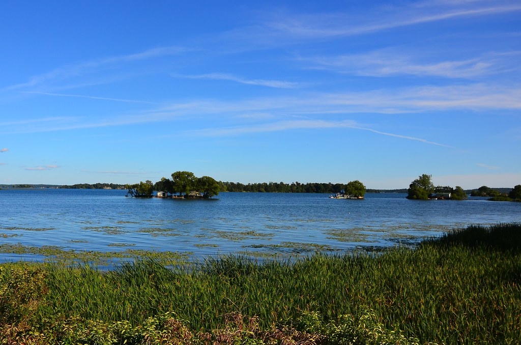
Lake Ontario turning into St. Lawrence river, 1000 Islands.
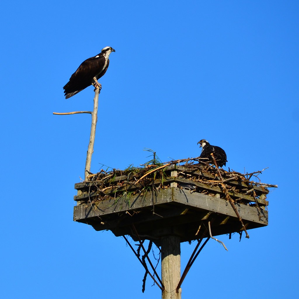
Another bird find: ospreys nesting along the parkway.
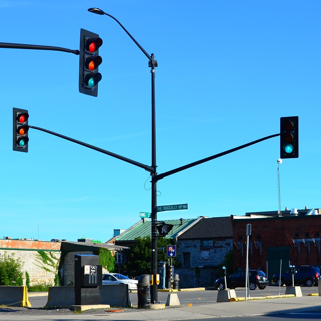
Before switching to highway 401 completely, we dropped by Kingston, which I have never visited before. Did not see much during the 15 minutes we spent there, except for the fun sign marking the Tragically Hip Way, in honour of the music band that originated in this city.
We stopped at a cute Hungarian restaurant in Gananoque, called Maple Leaf. Re-energised, we continued by the Waterfront trail westbound. Alex was hoping to take the Waterfront trail all the way to Toronto, but considering it was around 6:30 pm when we got to Kingston, there was no way we would make it home before nightfall, and travelling by unlit rural Ontario roads in the dark is only a good idea if you don’t mind the occasional deer coming out in front of you. We stopped for gas and came to terms with the fact that it would be the very boring 401 all the way from here on. It wasn’t too bad for a while, but as we got a little closer to the GTA area (when there was still about 100 km to go to Toronto), the traffic got denser and faster. In many ways a 250cc bike is just fine for travelling, but even going full throttle I was getting passed by every clunker in sight. It’s a long flat road and nobody is doing the speed limit. And if someone is doing the speed limit, you certainly don’t want to be near that crazy person. This is very frustrating, trying to pass a sketchy car when all you can muster is a 10 km/h speed difference. It’s an ungratifying experience, going at top speed of the TU250. On one hand, yes, it can do 120 km/h on a flat stretch for as long as it has fuel. On the other hand, going at 120 km/h as opposed to say, 110 km/h, results in a 25% higher fuel consumption. So whatever time you might have gained by going faster (not much) you will waste refuelling more often :(. All this was very frustrating for Alex, whose SV650 has a top speed that he never dared to even try and figure out.
When we got to Toronto it suddenly became warmer, both due to its great ability to collect heat and because everything was just so awfully familiar about it. It was already night, but it’s never really dark in the city, and every street light seemed to carve out an inviting path to our home. There it all was, 10,000 km later.
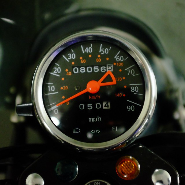
All of this started with only 1800 miles on the odometer. I think we can consider this bike broken in.
No Comments »
No comments yet.