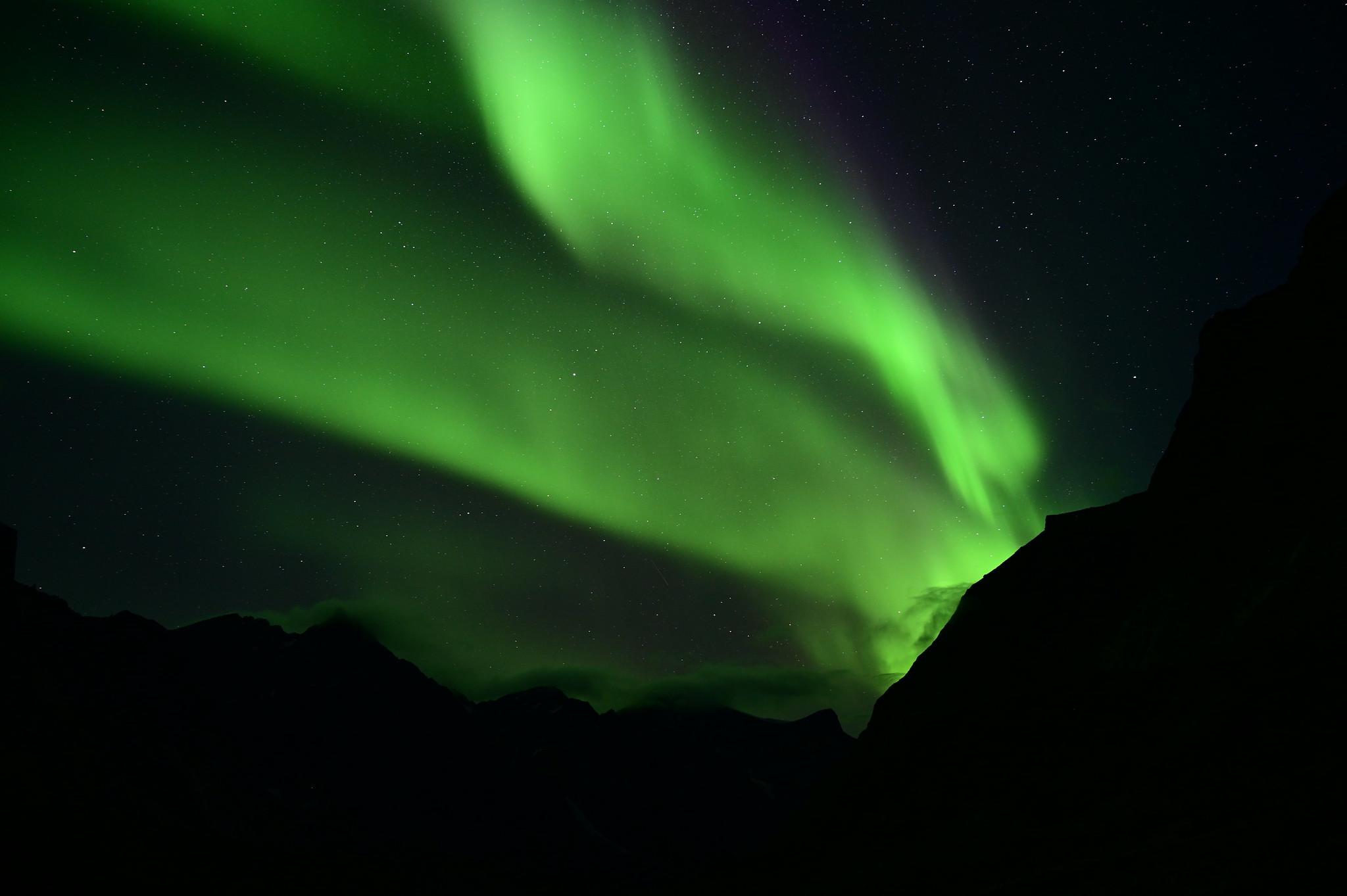
Aurora borealis in Auyuittuq National Park.
I don’t have a bucket list. For a long time, I would just go for things as they appear on my radar. I would not spend years planning for something. If you want to do it, why wait? Yet when I first went to Nunavut 3 years ago, I knew it was not the complete adventure. It was only an appetizer, a small bite, a trial sized trip as I get ready for the real thing. Ready how? Ready to take the time and do it, I was telling myself at first, but really, ready to go despite having some things I was afraid of. Like harsh weather and polar bears. Minor concerns. And then a small conversation with a stranger on a tangentially related matter convinced me to go ahead and make the call. The call to Aeroplan that is, to book the airfare. And then it was official. We’re going to Pangnirtung, we’re getting a boat to the Auyuittuq National Park, we’re hiking there for 10 days, and then, if we’re still in one piece, we’re going back home.
I stood in the tiny structure that acts as the terminal of Qikiqtarjuaq, and realized that adventures don’t begin on schedule. I haven’t set foot in Pangnirtung yet, haven’t hiked a single step across the tundra, but the adventure was underway ahead of schedule. Four flights separated us from Pangnirtung, and we made it for the first one with only 15 minutes to spare until the baggage drop close. The second was delayed by a couple hours, the third one, to Iqaluit, was perfectly on time, and the forth… Well, the forth is the one that took us to Qikiqtarjuaq instead.
When we landed in Iqaluit, we were supposed to only have an hour long layover, but it turned into 2 days. First it was “mechanical”. Canadian North (the airline) was having a hard time getting the planes and pilots where it needed them. So we stayed overnight, sleeping soundly to the sound of rain outside, which kept going all day and all night.

Walking along the bay in Iqaluit.

Backroads of Iqaluit.
The next day’s flights were delayed due to weather. Pangnirtung was covered in fog, and being on the shores of a fjord with tall mountains around, that airport has very strict weather requirements for landing. We ended up changing to a flight on First Air, whose pilots supposedly make more landings. We took off with a promise that they will try to land in Pangnirtung, if that doesn’t work, they continue north to Qikiqtarjuaq, pick up more passengers, head back south and see about landing in Pangnirtung one more time, and if that still doesn’t work, we all head back to Iqaluit and fly out the following morning.
We did meet an interesting guy on that plane to Qikiqtarjuaq. A long distance runner, Ray Zahab, intent on making the entire 100 km trek across Akshayuk Pass in 24 hours. For the 8th time. He said this hike is one of top 10 in the world, and he’s definitely seen a lot.
We also saw icebergs in the harbor of Qikiqtarjuaq. There are none of those at this time of the year in Iqaluit or Pangnirtung. I’ve never seen them before in my life.

Look, there is an iceberg out there, in these waters surrounding Qikiqtarjuaq.
And we had a curious incident where we forgot our trail snack, smoked Arctic char in the hotel room fridge, and when Alex came back to retrieve it, turned out 2 of the 3 fishes were already eaten by the opportunistic cleaning staff. They said it was tasty. He got some more at the shop.
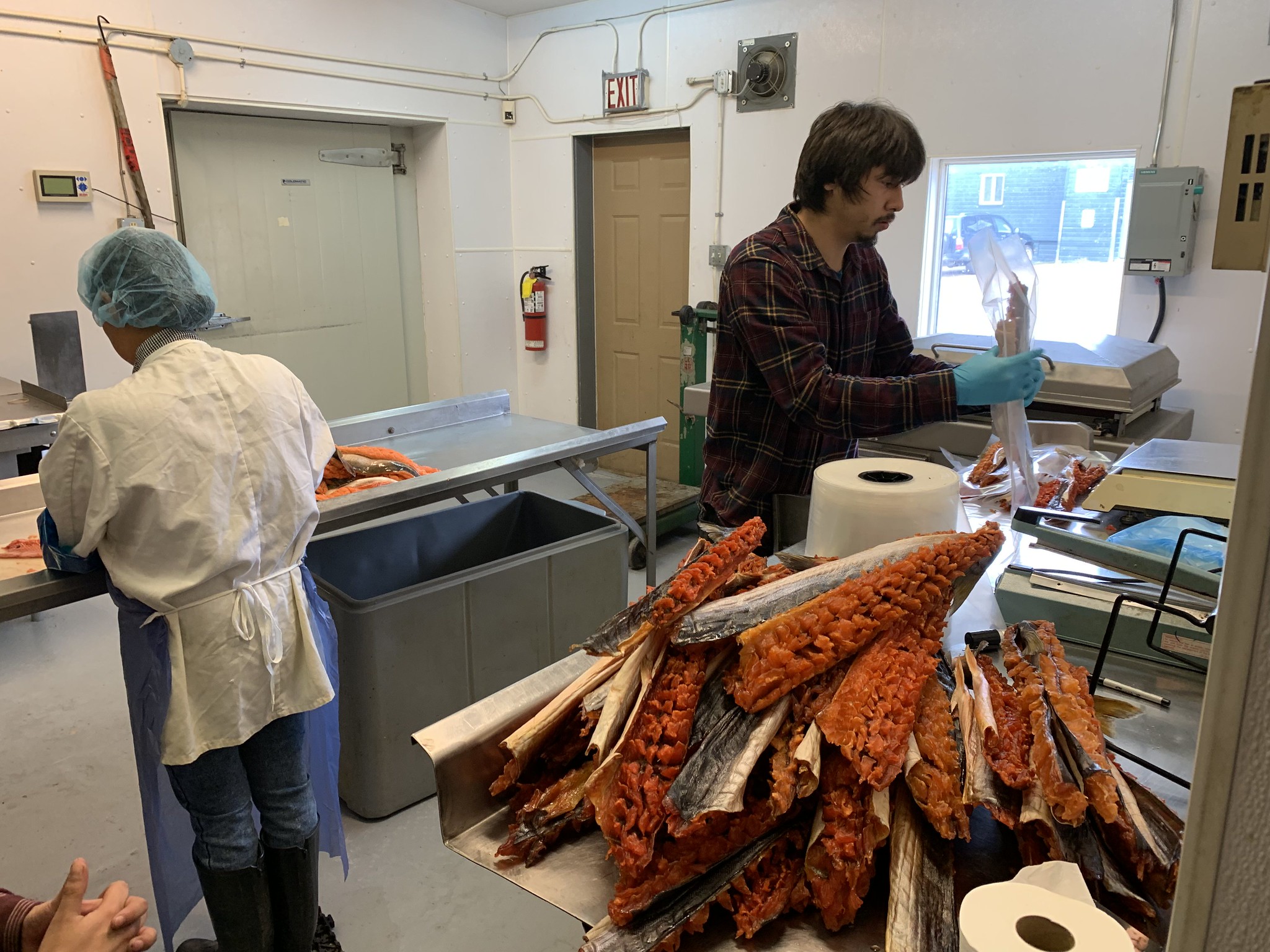
Behind the scenes look at the Nunavut Country Food store in Iqaluit.
As I finished noting down all these reflections in my journal, the plane flew by Pangnirtung, with the captain declaring that it’s still too foggy and we will not be landing there.

Hidden below all these clouds lies the Pangnirtung Fjord, which we will not see today.

Despite all attempts to avoid it, we are greeting another evening in Iqaluit.
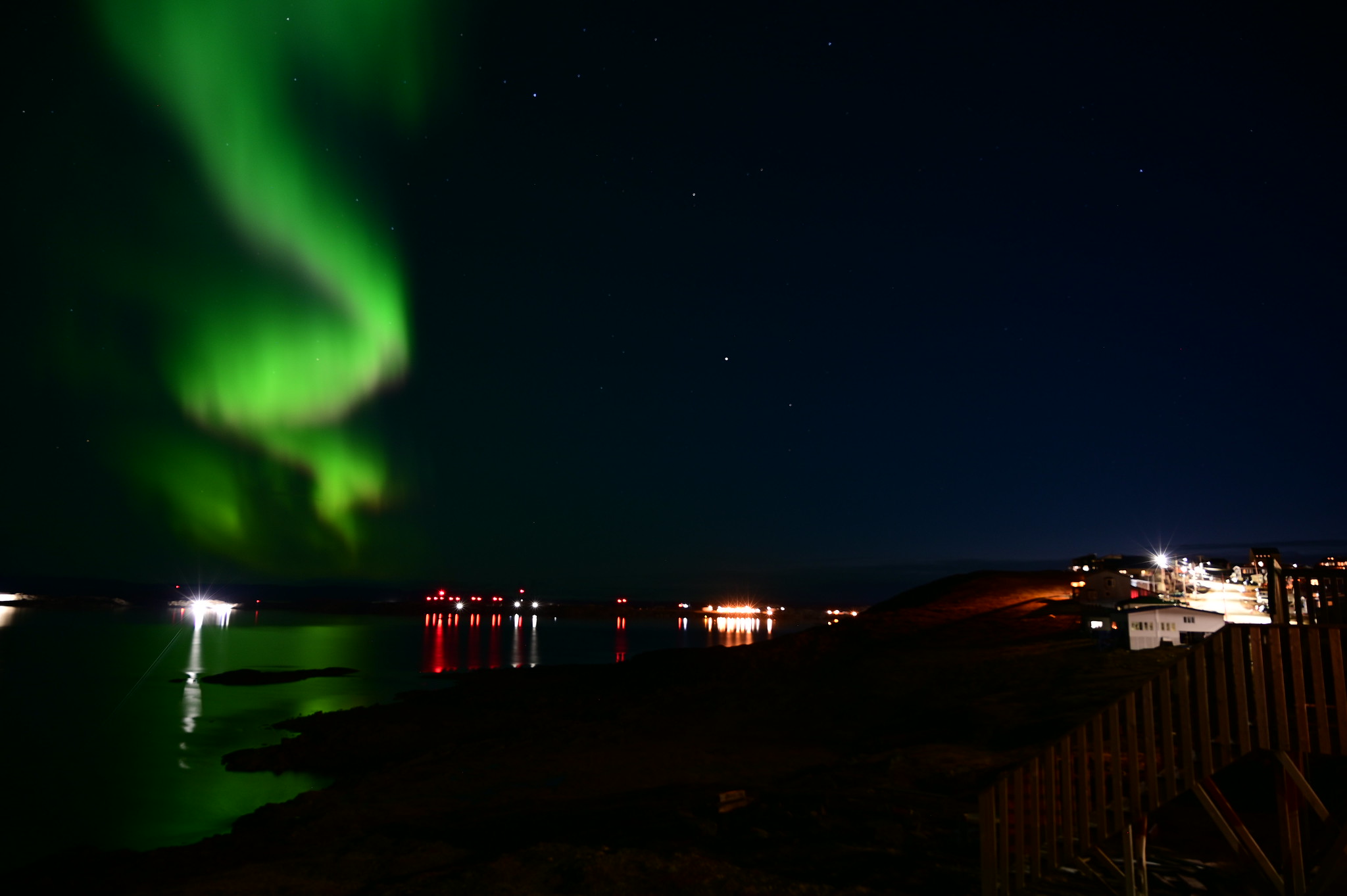
At least the weather cleared up in Iqaluit, and we were treated to our first helping of northern lights that night.

Northern lights over Iqaluit.
Did someone release the genie from the bottle?
September 3

The plane that finally took us to Pangnirtung.
The next morning everything works light clockwork, we get to Pangnirtung before 10 am, and it takes us all of 10 minutes to walk from the airport to the Parks Canada office. It’s that kind of town.
The boat is supposed to take us to the park in the “early afternoon”, whenever that is. During a thorough orientation session the park staff say there have been no bear sightings in the south half of the park, which is where we’re going to be, and with that concern addressed, we go to get lunch and look at the town. Apparently, there is a KFC there. We eat the popcorn chicken on the park office patio, which is overlooking the fjord. I think about 50% of the town has this view.

I only go to KFC once a year. A year ago it was in Shanghai, this time – in Pangnirtung.

A cute puppy being cute. I think most people have dogs around here. My cats would not enjoy it.

A supermarket that carries motorcycles? Sounds like my kind of town.
A few more hours later (we’re getting quite used to waiting at this point), we meet our boat operator, David, and I make a final pit stop to get more camp fuel. I pay using my watch, and the cashier is very impressed.
The map we have of the area says it’s 3 km from the typical drop off point to the first emergency shelter. It’s low tide so we end up going for a bit over 7 km instead. So it goes.

The boat is leaving and we can finally get started.

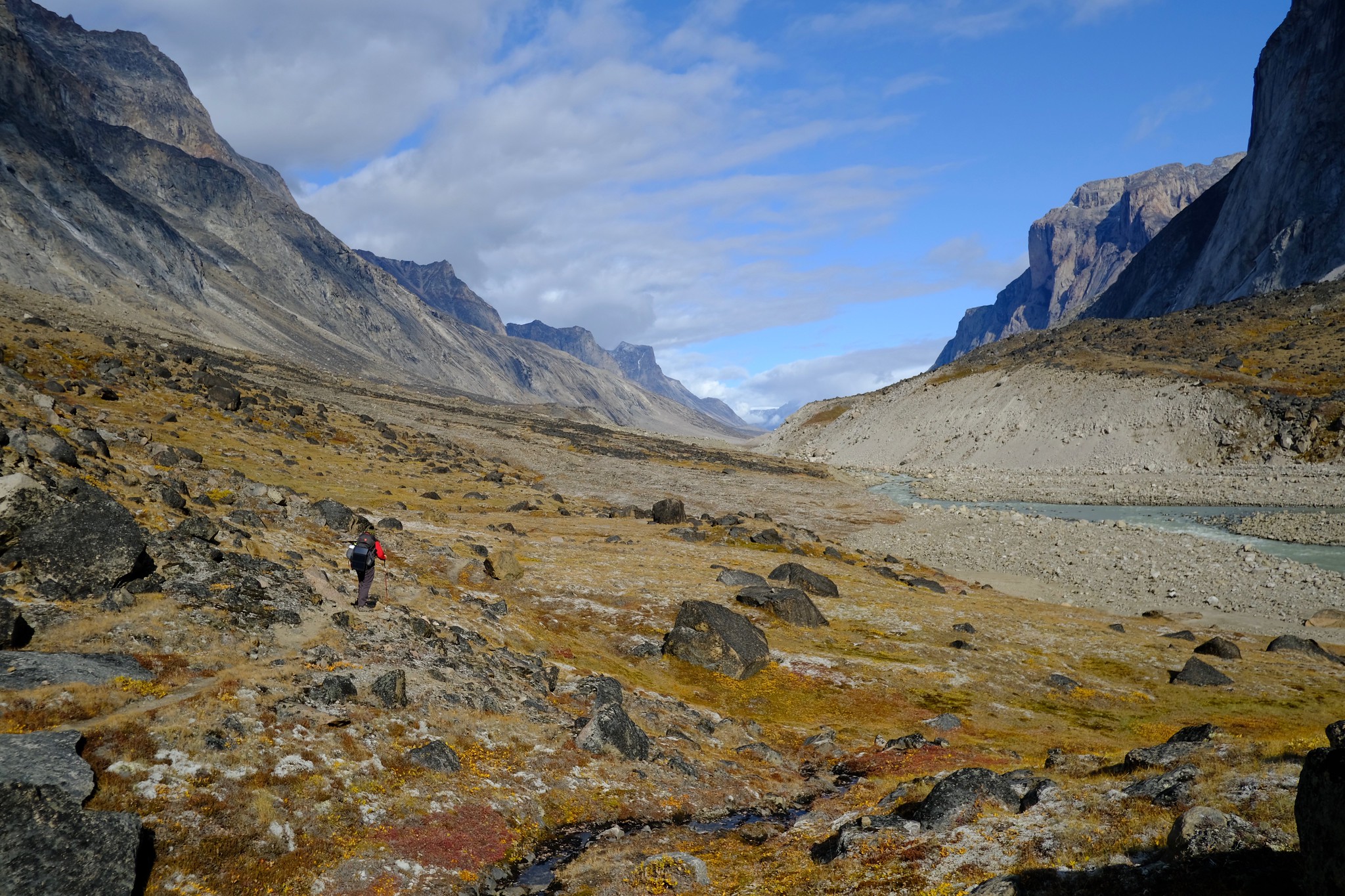
The first steps are a taking us through the tidal area of the fjord.
The trail just outside the park.
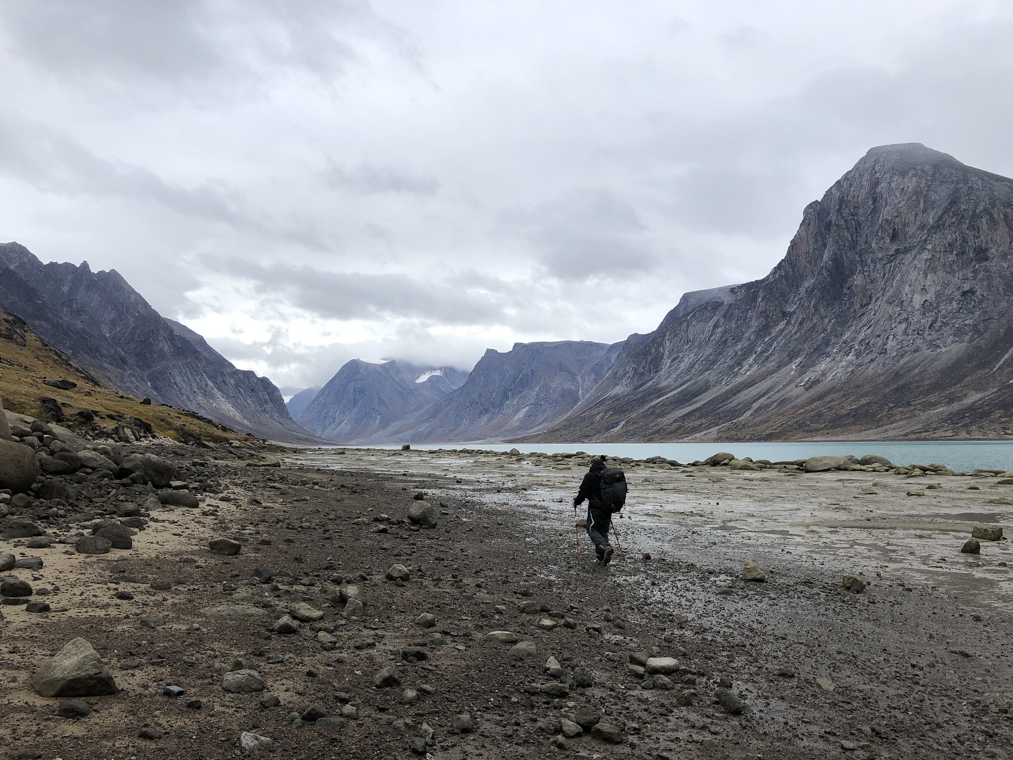
Hiking out from the drop off point.
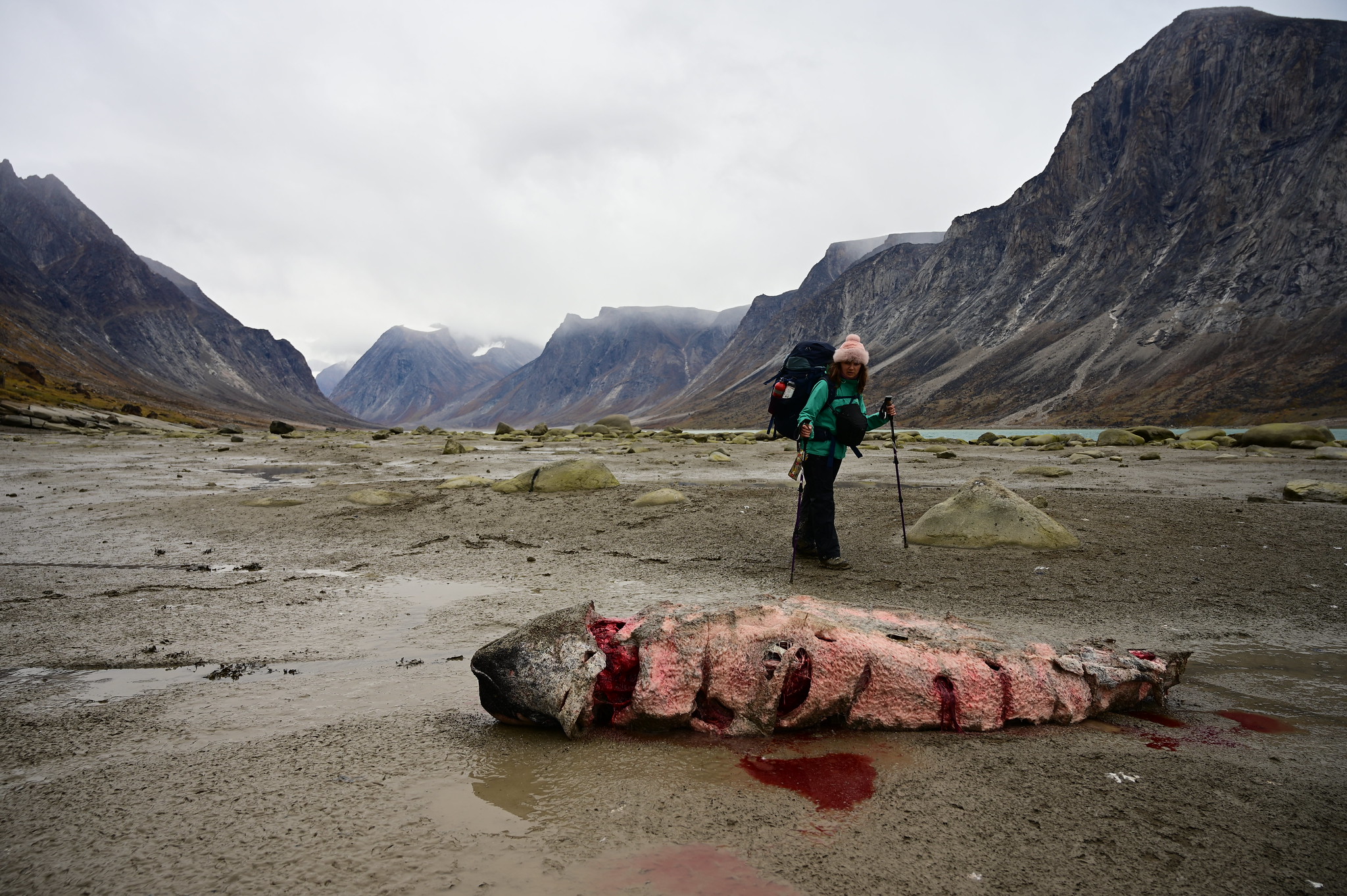
We pass by what appears to be a narwal. It’s not obvious, as it’s missing the signature tusk, but it adds up to that. We saw another one a bit further north, in a much later stage of decomposition, smelly and with guts spilling out. It’s common for Inuit to come out and hunt them. Despite their mystical appearance, these animals are not considered endangered so the Inuit are free to hunt them, as long as it’s not within the national parks’ boundaries (where firearms are prohibited). The tusks and skins are harvested, but the rest is left for other animals to take care of. This explains why we have seen several parties loaded up with rifles take off from the docks while we waited for our boat.

The beaches are sandy and the winds are strong. The effect is hypnotizing.

The berries! We’re told not to eat them, because they should be for the geese. But they are so good!

After three and a half hours of walking, we have finally spotted the Ulu shelter.
These shelters are not meant for you to stay in, unless you have an actual emergency, like, you lost your backpack in a river crossing (or in a fight with a bear), or the weather is extremely bad. We aim to stay near them anyway because they also have outhouses next to them, and because we figured they build them in places not prone to serious rock fall.
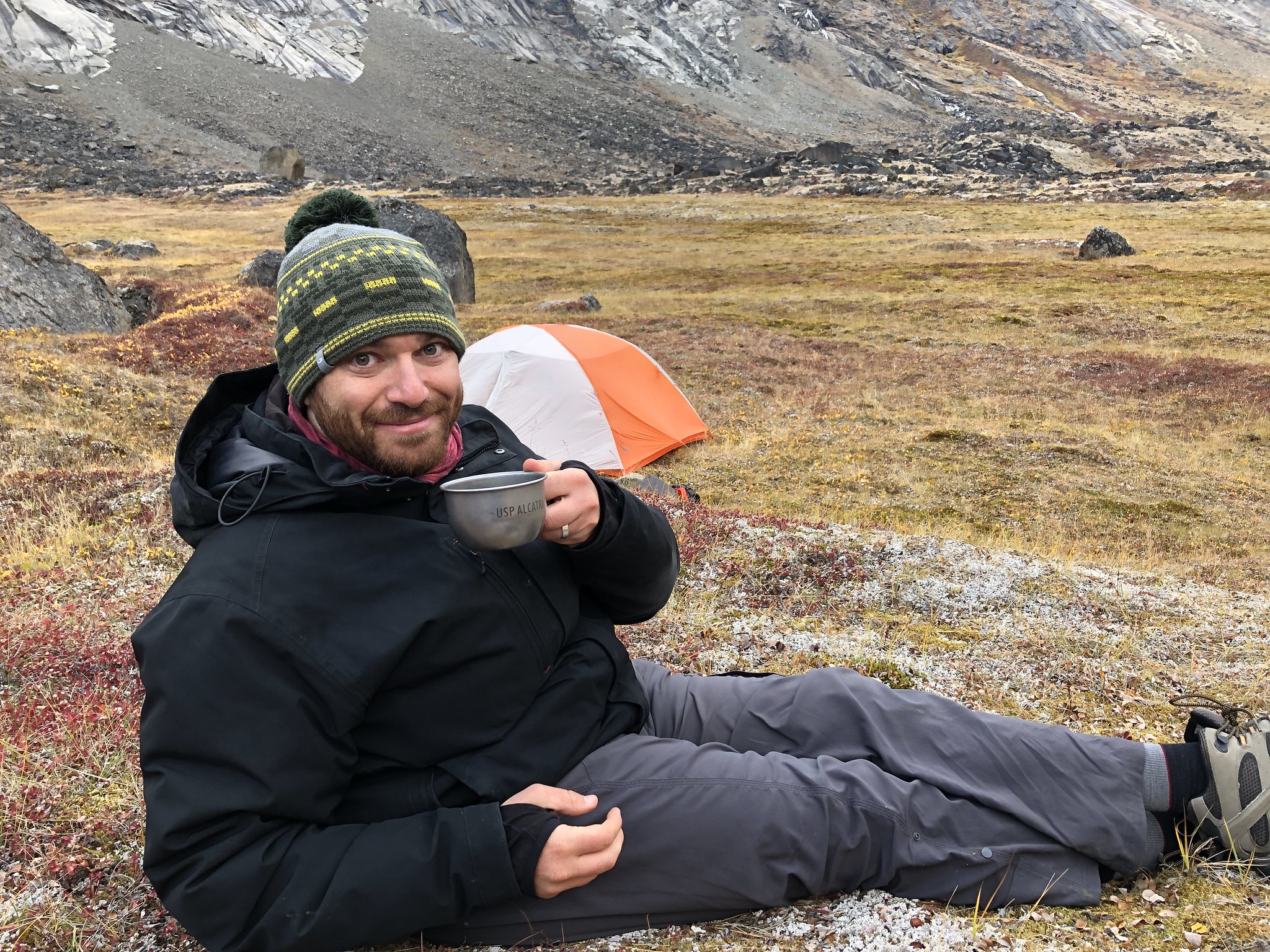
Speaking of which, the outhouse near that first one, Ulu shelter, was broken. So much for that. It’s windy, but we set up our tent by a huge rock that provides some protection. I have 20 packs of almost identical, home packed freeze dried meals (10 days, breakfast and dinner). It tastes good this evening. Wonder if I’ll still think so in a week.
September 4
We hope to make it to Thor shelter, which is 20 km away according to the map. Which sounds perfectly doable. We meet Ray and his friends, who seem to be right on schedule with their day long traverse. The weather is gorgeous, they appear to have had a rather enjoyable hike.

Mount Ulu and our camp in the morning.

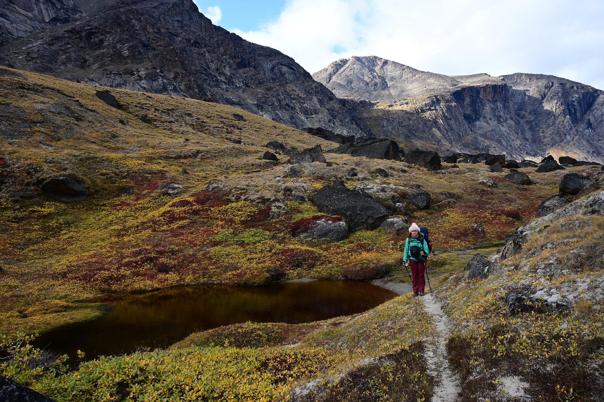
Just a few minutes from our campsite, miniature arctic plants are replaced by a rocky riverbed trail.

Tundra!

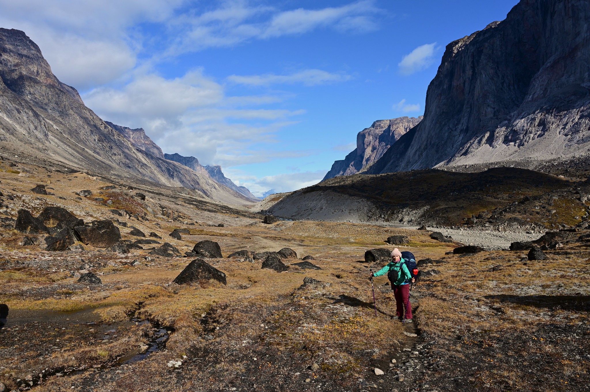
Take a break after the first couple of hours of hiking.

The sense of space here is unmatched!

At times you climb high, as times you get to walk right on the shore of the river.

Rest stop with a view.

The unexpected dunes near Crater Lake.

This sheltered section of the trail feels oddly cozy with its tiny pond.
It is a highlight of this section, and hides a surprise at the end…

Our first arctic hare spotting! He sat like that for a while, eventually relaxing enough to nibble on the grass in front of us.

The very official marker signifying we are about to cross an imaginary line.

Stretching our legs before tackling Crater Lake moraine.

I’m a professional, I have a map.

The wide and shallow river near Crater Lake.

Walking on the ridge of the Crater Lake moraine.

View from the Crater Lake ridge.

As we approach the Arctic Circle, the sunlight skillfully paints the valley in light patches.
Twice we face streams deep enough to warrant switching shoes for our knee high waterproof socks. It’s the best thing ever, these socks. The icy glacial water feels like nothing in them. Nothing!

The tundra in front of the falls is gorgeous!

Alex fording the creek that’s fed by the waterfall.
Around 5 pm we meet a group of hikers who tell us we are only about half way to Thor. The distances on the map do not quite line up with what we actually have travelled, but that’s ok. We get only mildly irritated. We hike as far as the southern end of Windy lake moraine, attempt to find a route up, but it’s getting late in the day, we come to our senses and set up camp. Dinner makes everything better.

Instead of getting over the Windy Lake moraine, we camp here. Mount Thor will have to wait til tomorrow.

These two keep running around together around out campsite.

At one point the grey hare comes over to the white one and slaps it in the face with its front paw. The white hare is so stunned, it sits like that for a moment before unleashing its fury.
It’s supposed to be clear skies that night, but having gone for a snooze around 8, we find it difficult to get out and look at the sky at night. That’s the downside of having really nice warm sleeping bags.
September 5
This time we make it to Thor. Aside from getting very confused regarding the route along Windy Lake, it’s a beautiful hike.

Alex prepping breakfast next to the Windy Lake moraine.

Here is the plan: just climb over this moraine and get to Mount Thor.

The trail turns from rocky to sandy.
Still no sight of Thor from here.

Fluffy arctic plants.

I almost fell over after taking this picture.
Hiking along the tundra.

With Windy Lake behind us, Mount Thor is so close, you can almost touch it.

Some sections of the trail are quite narrow and exposed.

Reporting live: Thor shelter is in sight!
No rivers deep enough to warrant changing into waterproof socks, so our sandals remain dry. We switch into them to let our feet breathe. Yes, you can wear sandals in the arctic. We make a gigantic batch of pancakes to celebrate the early finish of the hike. I think it is 3 times as much as we usually make. I get very stuffed by the end of it. With butter, and honey, and jam. Do not even want any dinner afterwards.

Pancakes!

Afternoon near Thor.

Arctic plants, they appear so fragile, but how strong must they really be to survive here?
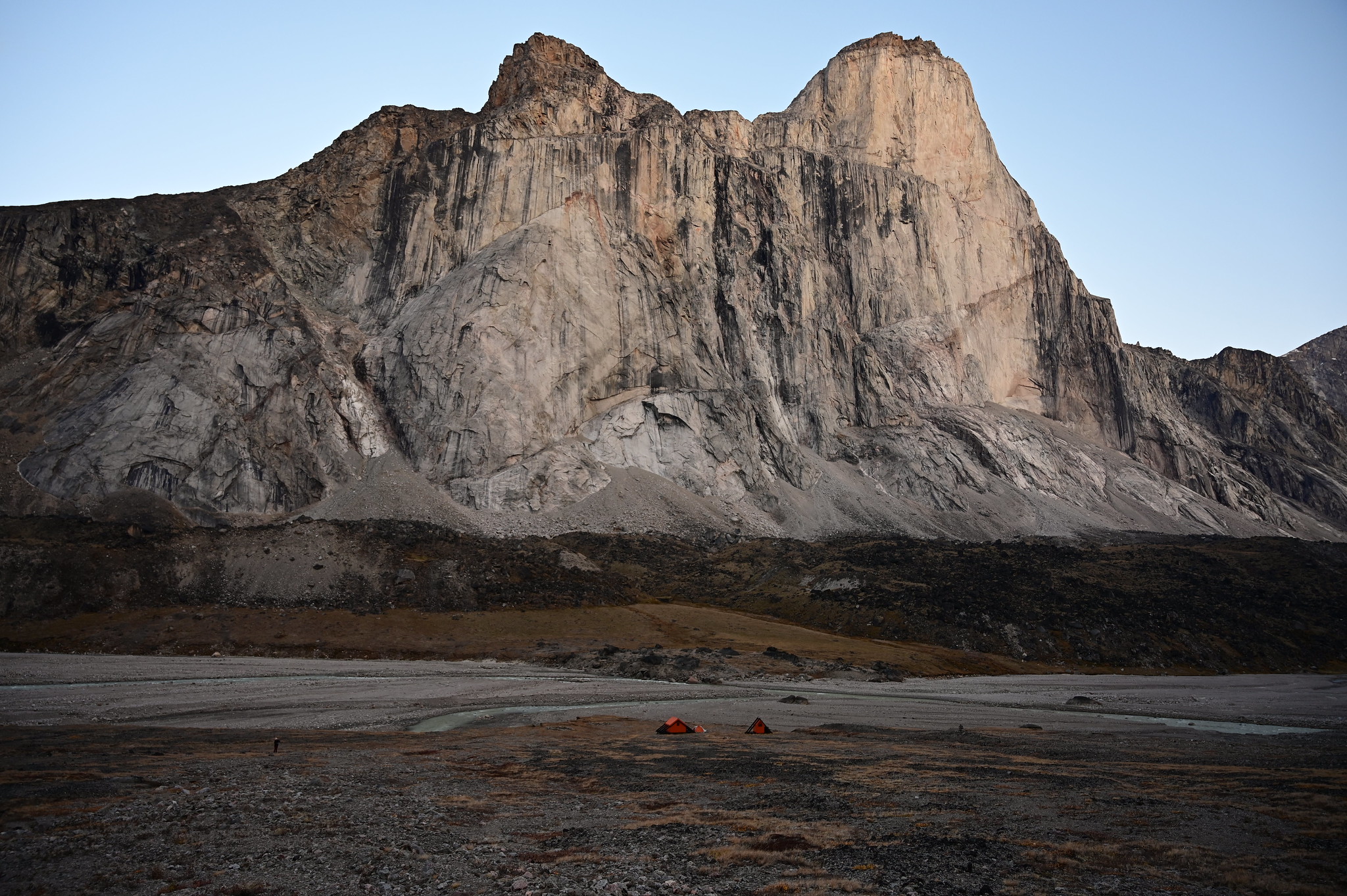
Our camp being dwarfed by Mount Thor.
The skies are clear and views spectacular. Knowing that once you get inside a sleeping bag there is no way back, we entertain ourselves reading the log book in the shelter, waiting for the skies to go dark and for the northern lights to come out.

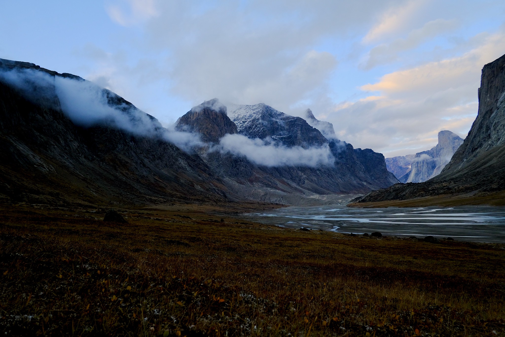
Darkness falls slowly over the Weasel river.
And they do come out, first shy and faint, then in full power across the entire sky. Since beginning the hike, I thought this place looks a bit like Yosemite. Not any more.

Auroras above Thor.

Auroras over the valley.

The lights keep dancing above Thor.

The dusting of snow on the peaks is lit up by the northern lights.
September 6
We hike another 10 km to Summit Lake. Meet a pair of climbers heading the opposite direction, they tell us there is another couple of hikers who should arrive to Summit Lake tonight, coming from the north end of the park.
The log book in Thor shelter was full of entries talking about Half Hour Creek, a major river crossing between Thor and Summit Lake. They expressed how deep and fast moving it was, how people were getting stuck there overnight, in hopes of crossing it at 5 am when the flow is lower, how they would turn back and not reach Summit Lake for fear of being stranded on the other side. They were all there in July and August. When we get to it in early afternoon, it’s ankle deep.

Hiking here, we’ve come to appreciate inukshuks.

The beautiful braids of Weasel river.

Gentle clouds break up the monotony of the blue sky.

Leaving Mount Thor behind is not a quick task…

Sunny days make for easy hiking!
One of the challenges we are not entirely used to are the backpacks. They are designed to be adjustable in many different ways, and sometimes they feel a lot more comfortable than others. The straps slip from their buckles over time, and we need to correct them. During one of these routine re-adjustment pauses, the slider buckle on Alex’s hip belt snaps. We manage to tie the loose ends together, but from now on it’s quite limited in how it can be tightened. Instead of resting on the hips, the pack now rests on the shoulders, and gets painful.

Northbound in glorious sunny weather.

Final approach to Summit Lake.
We make it to Summit Lake rather early, and commemorate the occasion with delicious ramen for lunch. I have been craving it for the past few hours, and it is even tastier than I imagined it would be. I think I might be coming down with a cold, and the savoury broth feels therapeutic.

Settled in and ready for some ramen. But not before a photo!

My dearest ramen, I’ve longed for you all day!

The full view of the valley from the ridge above out campsite. The emergency shelter is visible on the far right.

Evening light over Summit Lake.
No sight of the other hikers.
September 7

Morning meditations at Summit Lake.
Having arrived at the midpoint of our hike, we decide to have a rest day at this picturesque location. With no walking to do, we indulge in pancakes, ramen, lots of tea, flying a drone, and dancing to the tune of the Sugar Plum Fairy waltz in our heads.
We blow soap bubbles. Eat arctic char.
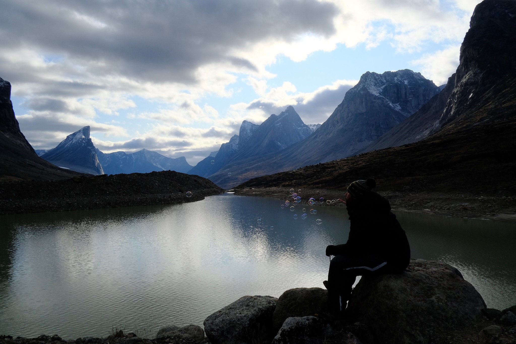
Blowing bubbles by the lake.

Blowing more bubbles.

Bird’s-eye view: the operational cabin is well visible at the bottom, the outhouse is just above it, and then the emergency shelter is further above. Our tent, also orange, is but a few small pixels in this photo, leaning into a large rock for protection.

The many moraines and glaciers of Summit Lake.

Mount Thor has its head in the clouds today.

Devouring the last pieces of dried char. The bears would have to fight us for it.
It’s such a luxurious feeling to sit here and eat delicious food in the sheltered area around the lake, with the view of Thor and other magnificent mountains around. The clouds come from different directions and shortly before sunset the sun comes out for a bit, letting us bask in its golden light.
Darkness falls and we are still blissfully alone. I hope the other hikes are not in trouble.
September 8
Although we don’t want to move camp yet, we do want to walk around. After observing the clouds for a bit, we decide that the nearby glaciers appear to be fogged up, so we plan to hike to Turner glacier instead, about 10 km further north. After getting on top of the first moraine, it looks like the nearby Caribou glacier may be clear after all, so we change direction and head there.

Looking north into the unhiked (by us) section of the park as we begin our ascent towards the Caribou glacier.
My slow brewing cold has taken a curious turn – my sinuses got blocked at the ears, and my hearing is drastically reduced. When I hike up front, I can’t hear Alex’s footsteps behind me, so every once in a while I turn around to check. It’s a bit funny because he does not anticipate me doing that and bumps into me as a result.

As we begin to hike, I notice a white rock, just left of Alex. Upon close examination, it turns out to be an arctic hare, snoozing in the sun.
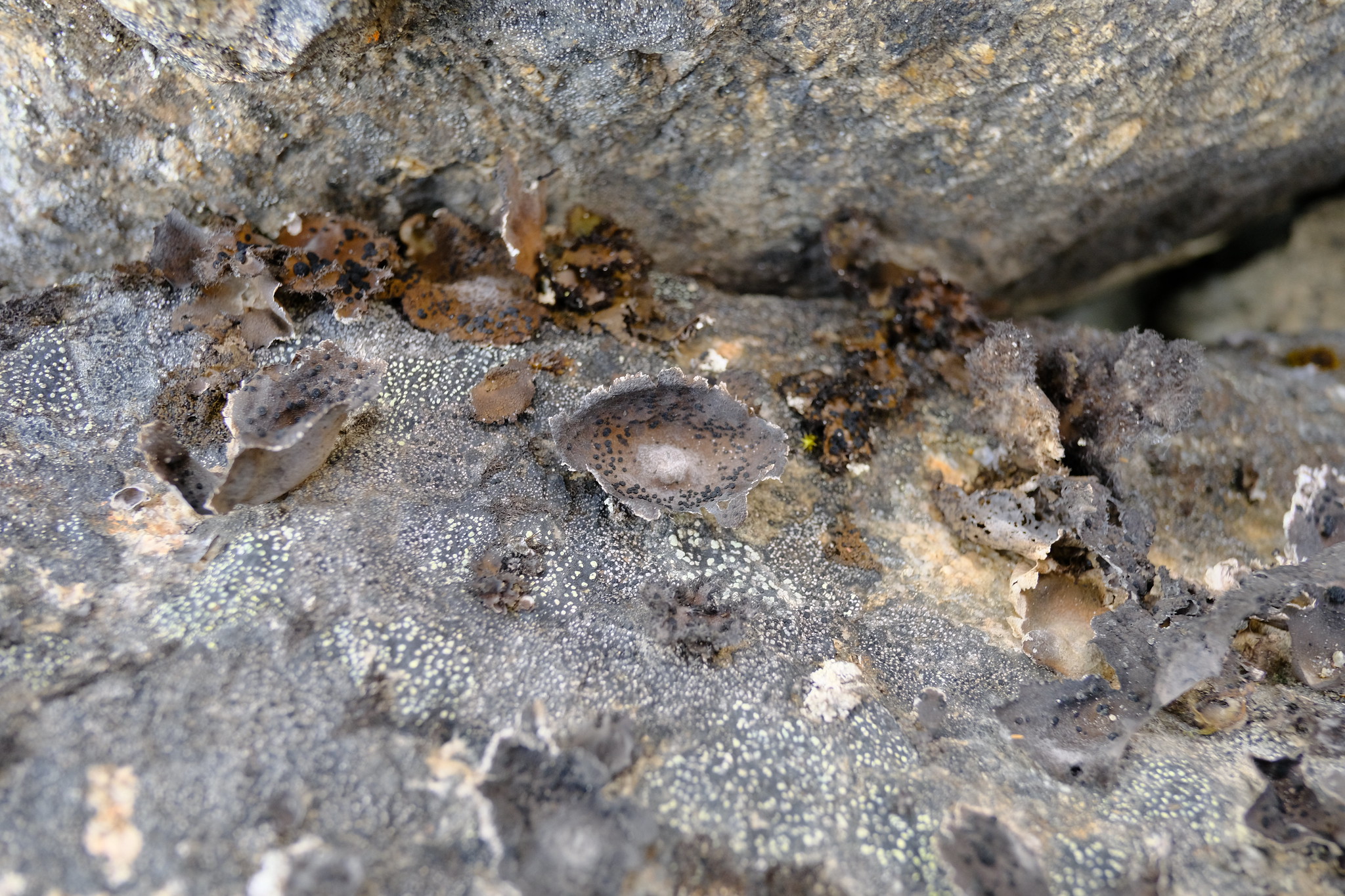
The delicate lichen on the moraine’s rocks.

Fast changing clouds add drama to the already magnificent peaks.

Clouds come and go and the mountains hold their ground in the face of the harsh elements.
Without large packs it feels like I can fly. We have to scramble up the slope as there is no trail, but it seems so easy. Too easy, as when we reach the final ridge before the glacier, we realize that the ice is now below us, not above. We overshot the climb up and now have to descend a bit. The rocks are very loose. I pause and see that we are actually on the glacier already: the rocks we were scrambling down on are simply debris sitting on top of the ice.
Every step feels like a gamble. The rocks we are climbing on shift around and I wonder if next time they will slide all the way down to the glacier floor. We decide to descend, and realize half way that there is a deep crevasse right below us, with water rushing at the bottom of it. Thinking this makes that plan a bit too risky, we opt to traverse the rocky terrain laterally. At some points the rocks disappear leaving only shiny bare ice. Crampons would have been very handy, but we don’t have them. Carefully planning every step, we make it back to solid ground, right in front of the lip of the glacier.

The thin layer of dirt hides a smooth icy surface. Why did I not bring crampons?

It’s beautiful here, but the wide crevasse reminds us to watch every step, and we are on a rather steep slope.

Alex is smiling in the face of danger. We still have to get past all the icy bits.

Once we’re clear, I have to go to the very edge of the glacier and observe the drops falling from the ice into the clear cold stream.

We are below the glacier and feeling much safer now.
With the most treacherous part of the hike complete, we leisurely make our way back up the moraine and over to our camp. It takes us another 2 and a half hours, but the sunset views of the valley we enjoy on the way are unforgettable. The light is glorious.

Sunset views from the ridge.

Alex being interrupted from his photographic pursuits to pose for a portrait.

This ancient dinosaur egg has been diagnosed with excess iron.
As we make our way to the emergency shelter, we notice hiking poles outside. Finally, the pair of hikers we’ve been warned about have arrived. We chat for a while, turns out they were delayed because they had to restart their hike when they realized their packs were too heavy. They are traveling with a dog, Ripley, who works as a sled dog in Iqaluit. She hangs around while we prepare and eat dinner, but gets back into the shelter to sleep.

Ripley keeping us company at dinner. Check out that delicious freeze dried, rehydrated mix – beef, peas, corn, broccoli, potato flakes and some spices. Mmm, nutritious.
September 9
Heading back we are so much more relaxed. Maybe it’s because it’s downhill, maybe because the trail is so easy compared to the boulder, scree and ice scramble of yesterday. We leave a little later than Gayle and Nathan, planning to camp out near Thor again.

Good morning! The view from inside the Summit Lake outhouse.

Heading back south from Summit Lake.

If this is what it looks like in autumn, I am curious how much this place flowers in the spring.

Leaving Summit Lake and heading for the shark fin of Thor.

Easy going: it’s downhill and we ate all the fish, so the packs are lighter.

A turquoise lake is hidden in one of the moraines.

The log book mentions that in the heat of summer this tiny lake can be tempting to jump in.
We make it to Thor shelter around 2 pm, just as Gayle and Nathan are preparing coffee. We keep them company while they eat lunch, sipping coffee and chatting. They leave to hike further south, and we sit inside, talking about life, universe and everything. That chat comes to an unexpected end as we hear what sounds like roaring thunder outside, look out and see a gigantic rock fall on the other side of the river, right across from the shelter. The cloud of dust is enormous and coming our way. We bring all our gear inside and lock ourselves in. In a minute everything is obscured by the yellow dust.

The rockfall moments after starting.

It is crossing the river and heading towards us.

It’s about to consume the outhouse!
It takes over 2 hours for this dust to settle – and it settles in a millimeter thick layer on all outside surfaces. Small clouds puff from under our feet when we dare to venture outside. Otherworldly is one way to describe it.
September 10
We wake up very early (that’s what happens when you go to sleep early), and head out into the dust covered landscape.

Soon enough the rain will come and bring colour back to the tundra.

We are leaving the Thor shelter slowly, to avoid stirring up the ubiquitous dust.

The arctic is colourful!

This is officially the tallest bush we had the pleasure of observing.

Low clouds passing by the rocky giants.
The few streams we face are very shallow, and we hike leisurely, knowing we have plenty of time. The weather is a bit cloudy, but that just makes it more moody, still majestic.

Enjoying the moody weather as Mount Thor still looms behind us.

The sandy beach and braids of the Weasel river on the north end of Windy Lake.

Dazzling reds of the autumn tundra.
The main challenge on this section is the moraine of Windy Lake. We take a different route around it this time. After an easy initial approach, the terrain becomes significantly worse. I see several loose ridges that need to be crossed, with no inukshuks or obvious trail. I continue by what looks like the path of least resistance and realize that in front of me is not a boulder, but a giant slab of ice. And another next to it. The meltwater slowly drips down from them into pools of dirty water, and the ice itself is embedded with numerous particles of dirt and large rocks. They are so dirty, you would not guess they are actually ice. This was not here last time. There must have been a significant rock fall here in the last couple of days.

This slab will likely melt before the winter. The larger Mount Thor in the background will stick around for much longer than any of us.

A large rock embedded into a gigantic slab of ice. It will make quite splash when it’s eventually released.
After getting out of the moraine, we begin to evaluate the potential camping spots. We’re thinking of Crater Lake as a back up plan, which is sheltered and quiet. Yet there would be no views in it, and plenty of sand, which is not ideal. Instead we find a beautiful spot right on the soft tundra, overlooking the Schwarzenbach Falls and Mount Thor. It is on the side of a hill, sheltered from the strong winds dominating the valley. The sky clears out with patches of blue. It’s the best!

The perfect place to spend the night before Mount Thor gets out of view again.
Enjoying a cup of tea in the perfect camp spot. Chocolate not shown, but eaten.

I am told you can actually eat some of the mushrooms here. Well, maybe you can eat all of them, but the red ones will send you off on a kind of trip you might not want – they say the Vikings ate them before battle. To numb the sense of self preservation, I assume.

View of our tiny tent in this enormous landscape.
The view from the tent.
September 11
I wake up in the middle of the night and realize there is a drizzle outside. Finally, the end of our dry streak. When I wake up again around 5 am, there is already some light, and the drizzle keeps going. We contemplate whether it makes sense to wait it out, or to get going. Whether it makes sense to get a weather forecast, or if it won’t be precise anyway. We decide to give it until 9 am and then if it still rains, get going. However, after briefly venturing outside, we realize the rain is really light, so we make breakfast, pack up our wet tent, and find ourselves back on the trail at 8:30 am.
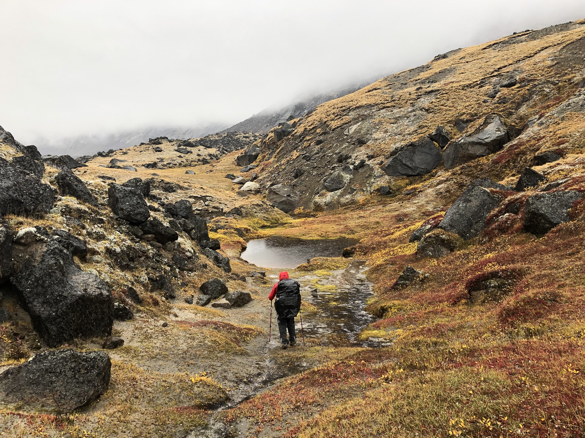
It takes us an hour and a half to get to Crater Lake – mostly because we get stuck trying to find a good crossing point on the sandy beach in front of it. We decide, once again, to cut across in a straight line instead of hugging the rocky shore. And again, we get stuck with multiple routes being blocked by quicksand. We eventually switch to waterproof socks and find a passable way. From the wall of the Crater Lake moraine, the trail is easy to find and easy to follow. It takes us only 30 minutes to get to the bottom of the valley on the other side.
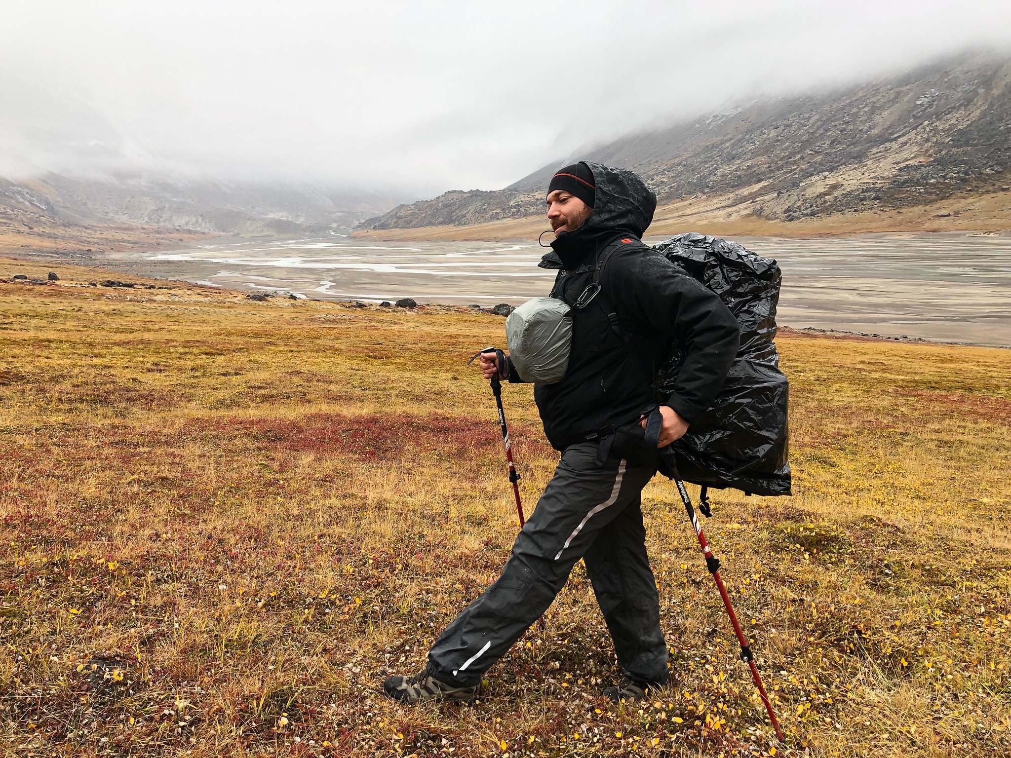
Alex modeling the latest in waterproof backpack gear: a gigantic trash bag with strategical cutouts for the straps.

We cave in and cross the stream where it’s just deep enough to require a change of footwear, but at least it’s not quicksand.

This section of the river pissed me off so much, I decide to piss on it in retribution. Because I can, even without exposing my behind to the arctic cold: https://www.thepstyle.com (no, I don’t get any commission from that).
The rain is getting weaker at times, but does not let go completely. The low clouds neatly demarcate the newly painted snow line on the surrounding mountains. It is gloomy, but also very beautiful. There are no more major obstacles, just the small creeks, rocky beaches, and marshy tundra. My cold symptoms are at the worst in the mornings, but I get slightly better as the day goes on. I still feel a bit deaf, and my eyes are very irritated and dry.

Moody hike along Crater Lake.
A pond spices up the view in this tundra patch between the moraines.

Low clouds hang over the valley as we approach the Ulu shelter.

Foggy and snowy mountain peaks near Ulu mountain.

The afternoon turns unexpectedly sunny, just a couple of hours after the previous foggy photos were taken.
The terrain is easy to traverse, and we make it to Ulu shelter, our last stop on the trail, after only 4 hours of hiking. Gayle, Nathan and Ripley are there.

Gayle, Nathan and Ripley heading out for their pick up. Look at those smiles!
Their pick up is at 4 pm today, ours is tomorrow. Would you like to head out now and get back to town a day earlier, they ask. The rain has stopped now. The sky is crispy and blue. I turn my red eyes towards the mountains looming around us, the fresh dusting of snow on their peaks, the open valley to the south. We still have tea, chocolate, mashed potatoes, and a couple of full drone batteries. No, I respond, I’d like to stay one more day.
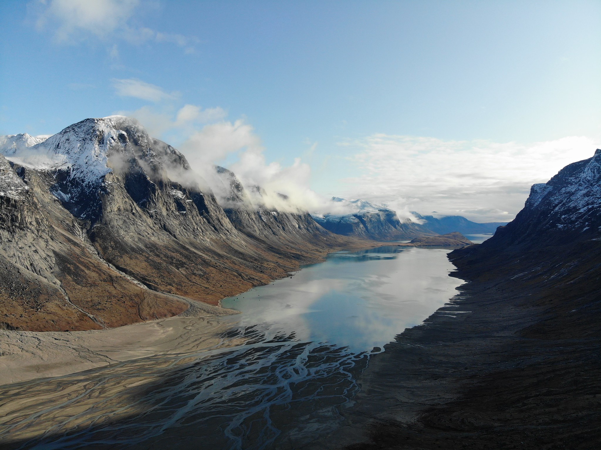
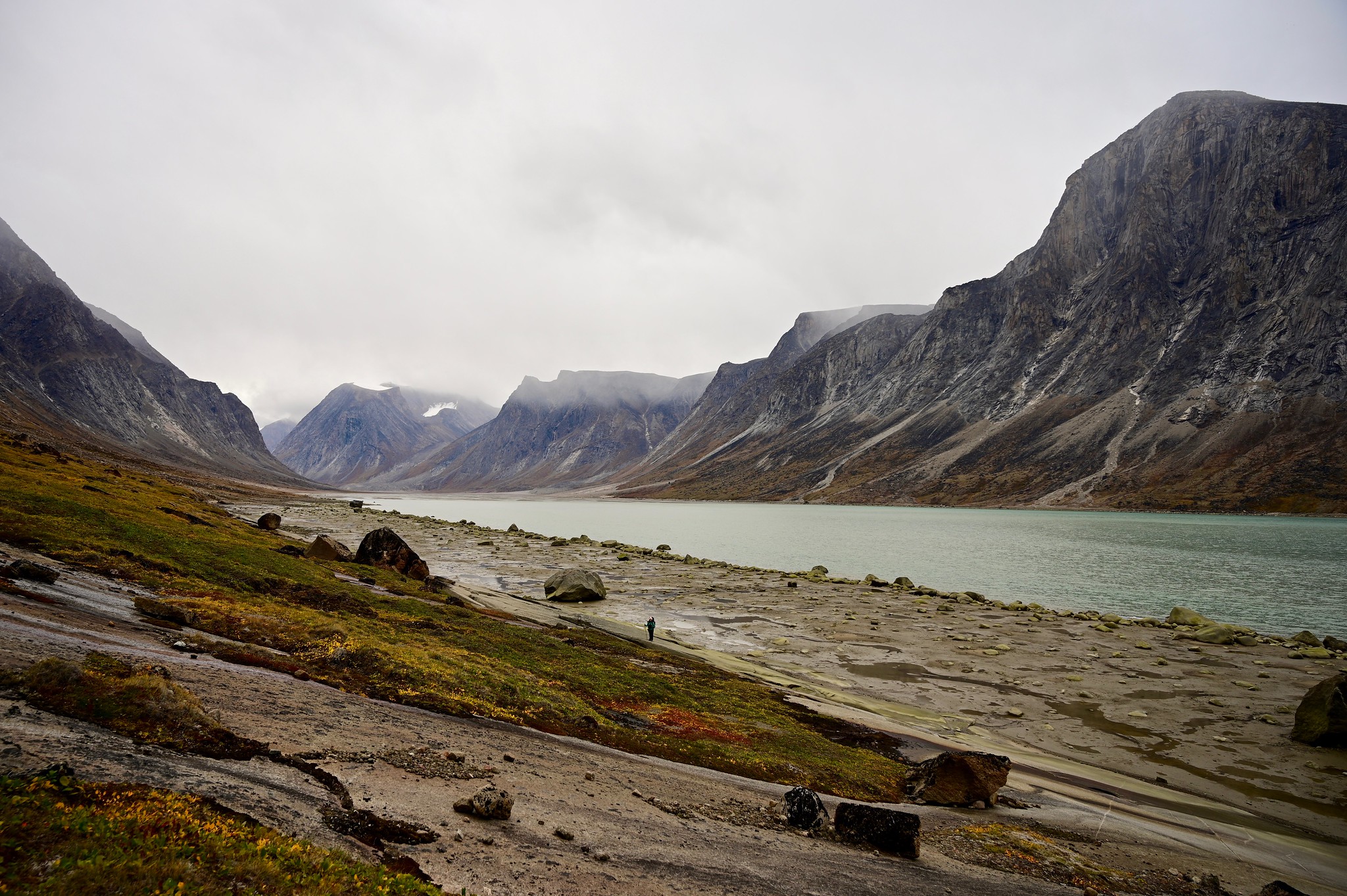
Weasel river merges into Pangnirtung Fjord, marking the boundary of the national park.
September 12
Whenever the last day of an adventure comes along, I get a weird sad feeling. I want to savour the remaining time, but the impeding end feels heavy, and I want to rush it, just to get it over with. It’s a feeling I’d like to learn to avoid.

Feeling small among these giants, we sit and enjoy a few last minutes before we have to pack up our things and leave the gorgeous park.
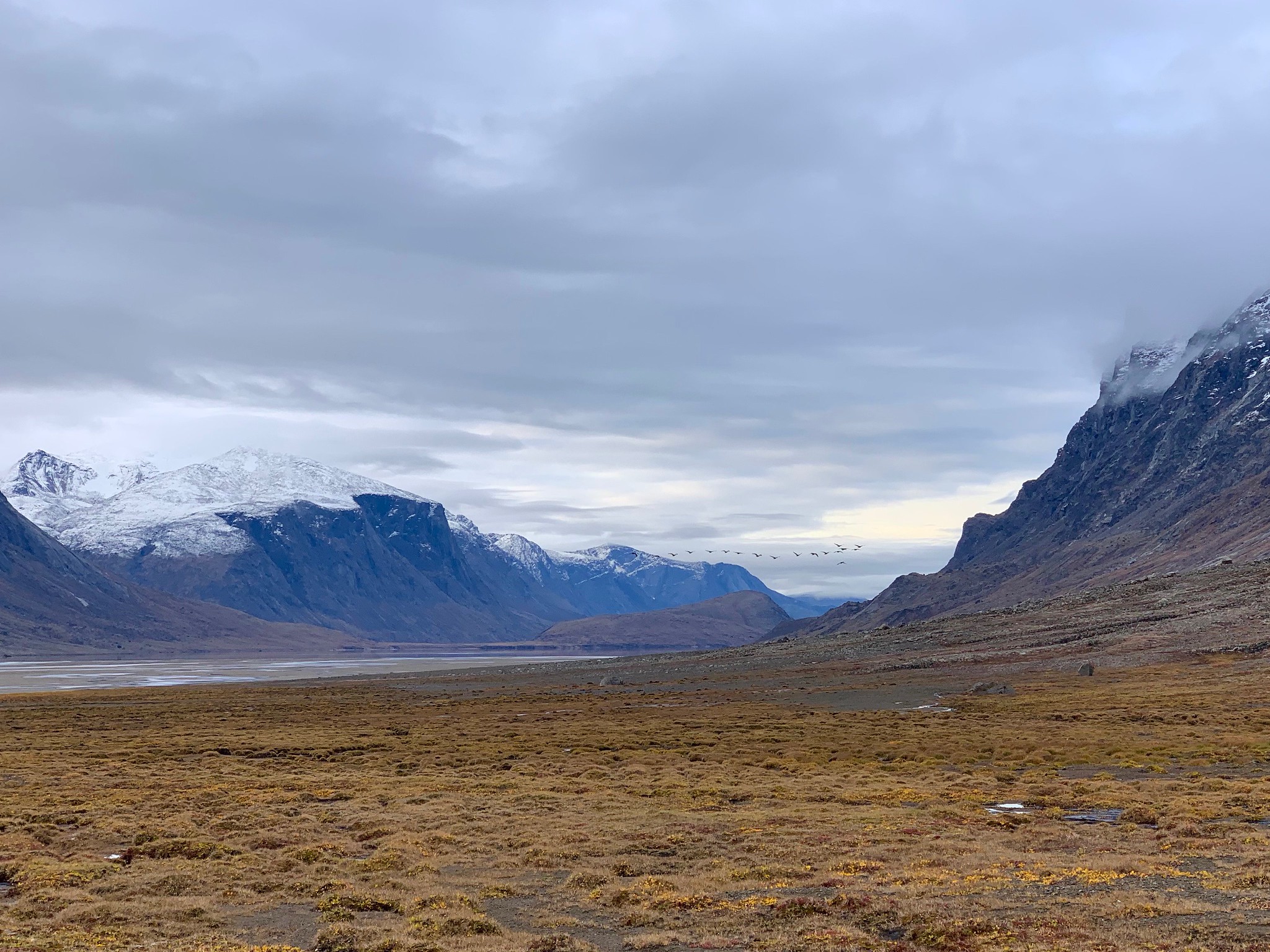
The geese are flying north! Not sure why, but that’s what they have been doing every time we see them fly. Gayle mentioned that it surprised her too, and that she screamed at them that it’s the wrong way.
This time we match the pick up time to high tide, and it only takes us 3 miles of travel to reach the open fjord. The boat comes in soon enough, and we find ourselves back in Pangnirtung in no time.

Dodging soft marshes as we leave the Ulu shelter.

Walking along the sandy track to the pick up spot.

The park’s final gesture is to wave to us with a rainbow.

Looking out into the fjord, waiting for our boat.

Matthew picks us up promptly and off we go towards the open fjord.

Back to civilization! As a responsible backcountry user I have just deposited the bag containing 10 days worth of trash into the dumpster behind me.
After checking in with the park office, we head to our bed and breakfast, where the host, Markus, volunteers to make us dinner. He poses it as a question, but who would refuse a home cooked meal with fresh vegetables, after spending 10 days eating dehydrated meals.
After a hot shower we take a walk around the town. The open water on the far end of it merges perfectly with the sky.
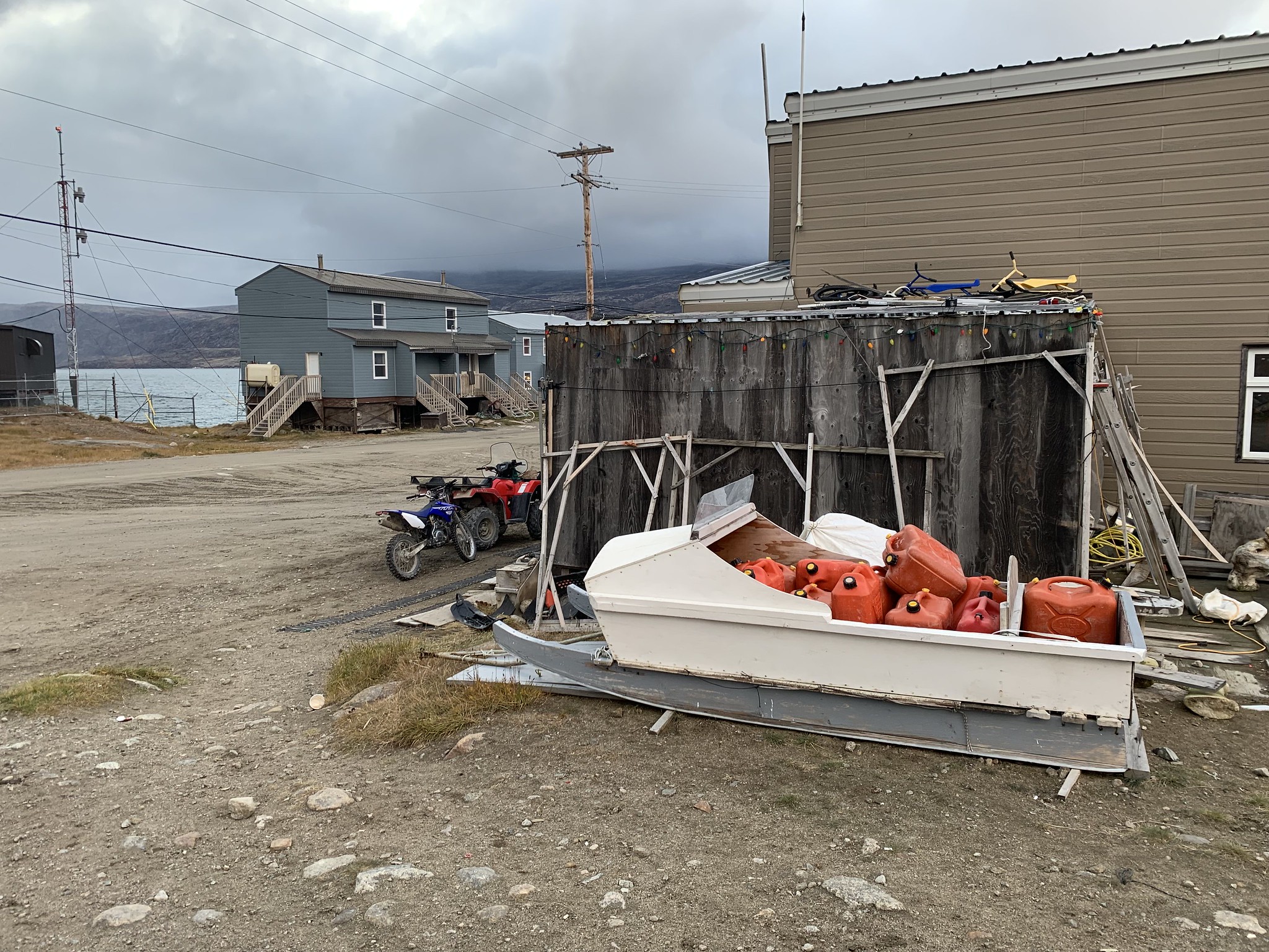
A qamutiik sits waiting for the winter. It doesn’t take long to go somewhere very remote and isolated, so having enough fuel is a must.
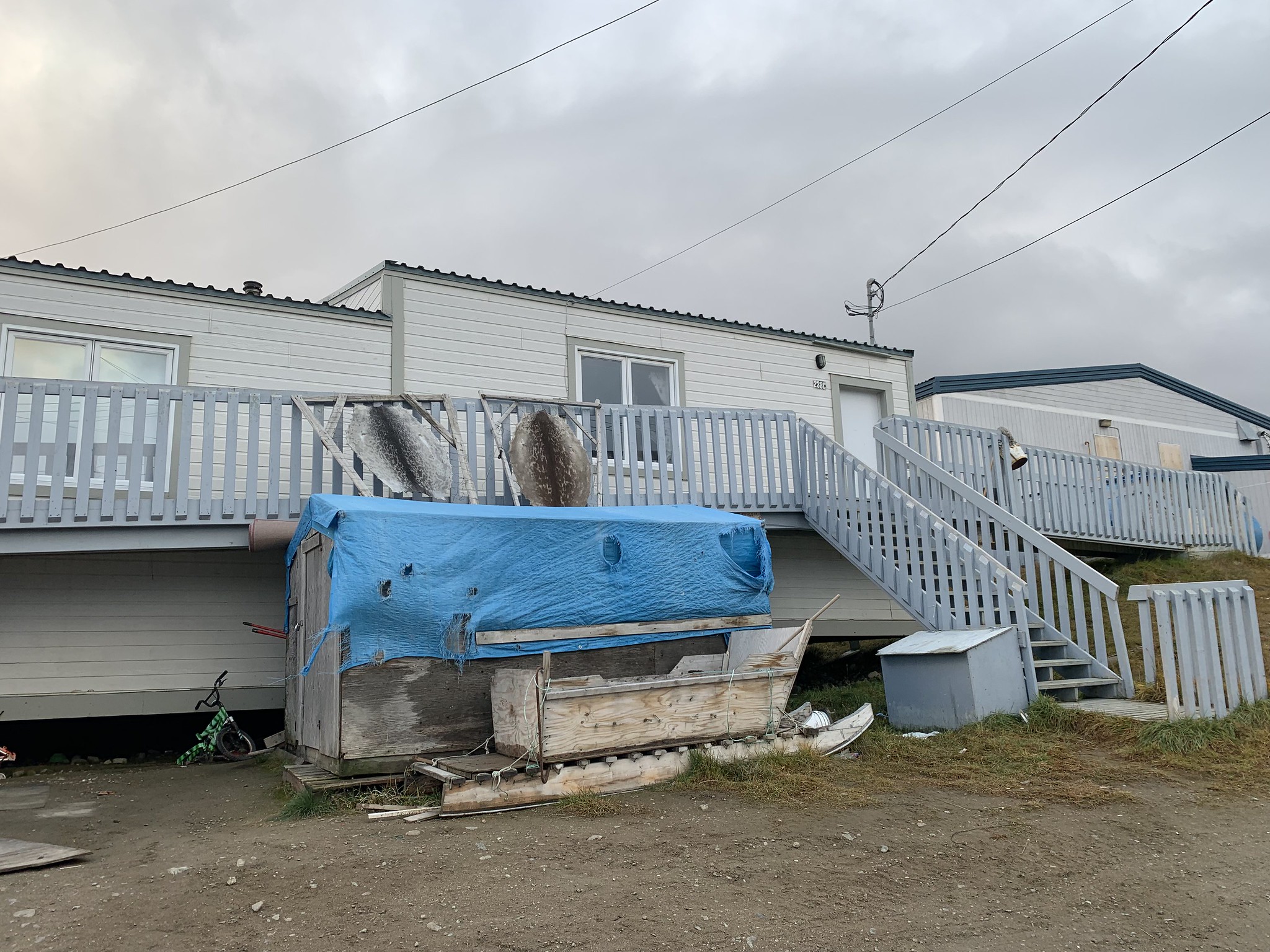
Seal skins are drying outside, common sight around here. Harvesting seal skins, narwal tusks, local berries and other bounty from the land is one of the main sources of income for many residents.

A bicycle is “parked” in front of the former Hudson’s Bay Blubber Station.
We spend a long time at dinner discussing all sorts of things, and find out a lot about life in these isolated northern communities. Perhaps some of the ideas we bring up will be helpful, as Markus has ambitions to improve the lives of people who call this place home. He was not born here, but has lived in Pangnirtung for 40 years. It might seem isolated on some level to live here, but then again, you can stand in the middle of the street in downtown Toronto and be deeply alone.
September 13
As I cozy up in the living room armchair, gazing at the fjord, Markus offers to give us a tour of the town. Off we go to see sights, hear stories, and meet people.

Fooling around on the porch of Marcus’ place.
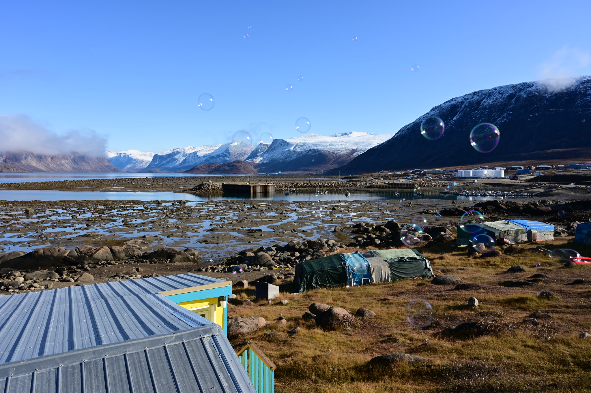
Bubbles over Pangnirtung. Fresh snow fell overnight on the mountains surrounding us.

The perfect fjord view from the warmth of the house.
The scene of a multi vehicle collision in Pangnirtung.

Looking south from Pangnirtung towards the Cumberland Sound, which appears infinite from here.

Looking back at the town, you can see the satellite dishes that make up their only communication links.

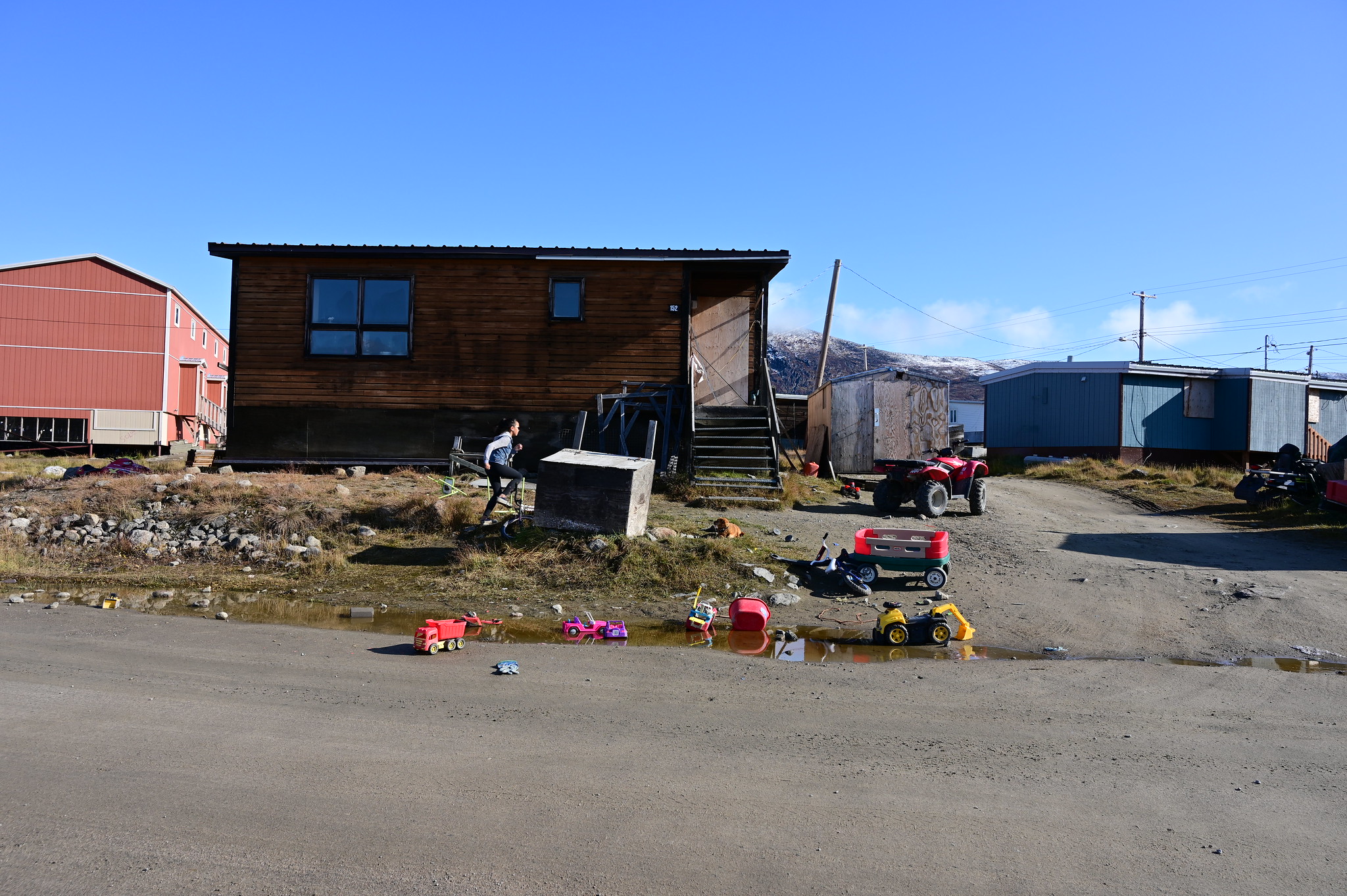
We interrupt a local girl, who was busy climbing the doors of the supermarket, to give her the bubble blowing apparatus.
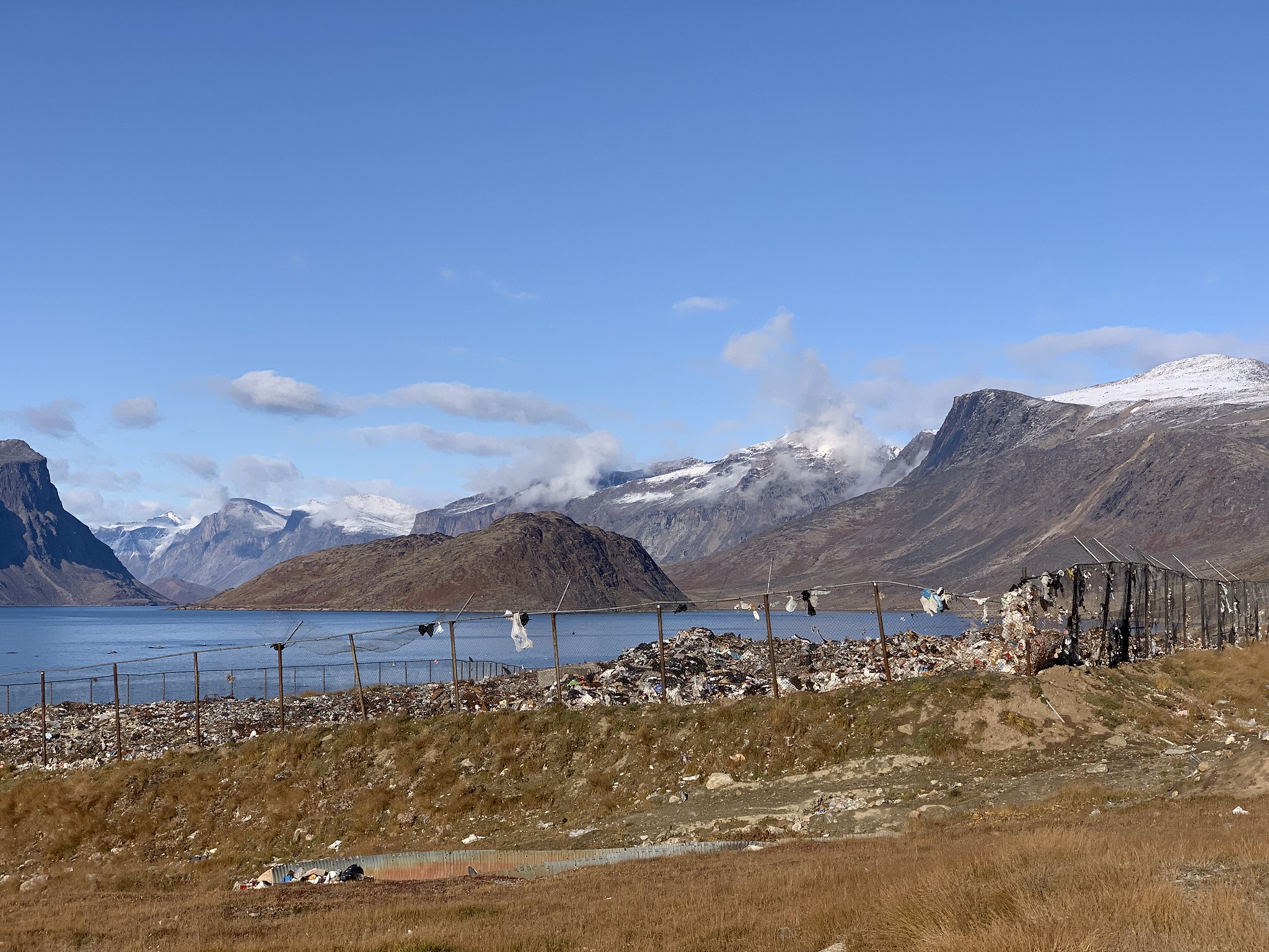
Trash dump with the best view? It’s quite an eyesore, but the hope is for the town to get an incinerator at some point.

At the north end of the road is an archeological site of the Thule people. These people inhabited the area before the Inuit. You can’t quite tell from the photo (and it’s hard to tell in person as well), but the rocks in the foreground are remnants of their housing structures. This site was almost destroyed when a construction company came here to dig up some gravel for a project in town. They couldn’t tell it was an archeological site, and somehow that information was not communicated to them when they were hired. The site remains, but it is difficult to appreciate it in full with the construction equipment just meters away, and most of the adjacent tundra removed to obtain the gravel.
One might wonder why people continue living here, despite the numerous difficulties and struggles. It’s hard to explain in words, but having spent some time here, a certain understanding forms on an almost subconscious level. It’s different in so many ways from living further south (they don’t even consider Iqaluit to be proper “Arctic”), but it’s different in ways you wouldn’t expect, wouldn’t anticipate as a southerner. A significant point of friction is the mental disconnect between the people actually living in the arctic territories and the southern people running the country. The kinds of projects that have been stalled for years (like mental and physical health facilities), the kinds of projects that go ahead without much deliberation (multimillion dollar dry docks that nobody ends up using) — the choices made by people in power are often not in sync with the needs of the local communities. Strategies that work in Toronto (or even Ottawa) don’t necessarily work here, and I’m just disappointed that it is taking so long for our country to figure this out.

Saying goodbye to Markus on the porch of his home.
At 6 pm we board the plane to Iqaluit and leave Pangnirtung behind. The golden light is warm on our faces. It is bittersweet, like all departures are.
September 14
We have a full day to spend in Iqaluit. We start by walking around town and keep our options open for the evening.

Outdoor art in Iqaluit.

The very hipster Black Heart Cafe. You know it’s the place to be when London Fog is on the menu.

The view from the bed and breakfast bathroom. There are huge wall to wall windows there, facing the bay.
Our cellphones have no coverage here, and no free wifi anywhere either, so our communication options are limited. We head back to the hotel to rest and check messages. I get one from Gayle saying they are having a campfire that evening by the river. So we start off by going to the newly opened Nunavut Brewing Company.

A beer flight at the Nunavut Brewing Company
Having sampled the brews, we head out into the darkness to find the campfire. It’s a long way, but not as long as the way to Summit Lake. We don’t find Gayle, but do observe more northern lights.
Others are there enjoying the campfires. Seems like chilling on the shores of the Sylvia Grinnell River is a common pastime for many of the locals. We chat for a bit, and eventually ask them to call us a cab.
(I later find out that Bell purposely does not allow others to roam on their network in Iqaluit. How mean of them.)
September 15
After resting for a few days, we feel that it’s so wasteful to have all this time on our hands and not use it for walking. So we decide to hike the Apex trail from our hotel to the center of the town and continue all the way to the airport. Considering how small Iqaluit is, this idea is not nearly as crazy as it sounds.
In the airport we finally catch up with Gayle and Nathan, who also have their outbound flights scheduled for today. They look oddly different than they did on the trail. Perhaps so do we.
I have a strange sensation. As much as I try to focus on new places to explore, I feel that I will see this place again. Some day.

Last look at Iqaluit
What an absolutely fabulous blog you have created as you managed to weave a wonderful story with some truly beautiful & well-taken photos.
I am truly envious!
have mercy,the view an hike were a Blessing.not many folks GET TO experiance such beauty. We hope youall have many, many more. the rockslide was really something. GODS Speed, from south Louisiana