We woke up to find out that nobody rolled off the edge of the cliff into the canyon. That’s always a good thing. Since we gave up trying to cook breakfast while camping a long time ago, the morning routine consisted mostly of packing up and riding around a little, just to check if the canyon looked any better from another vantage point. It looked about the same.
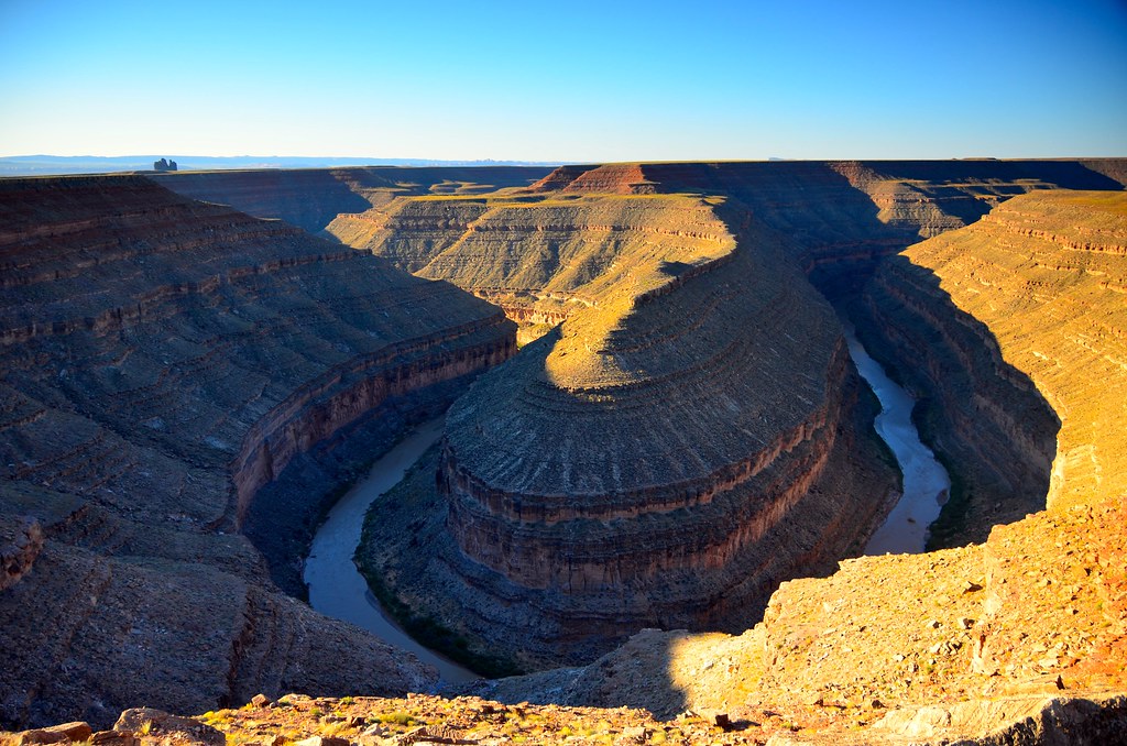
The Gooseneck of San Juan River
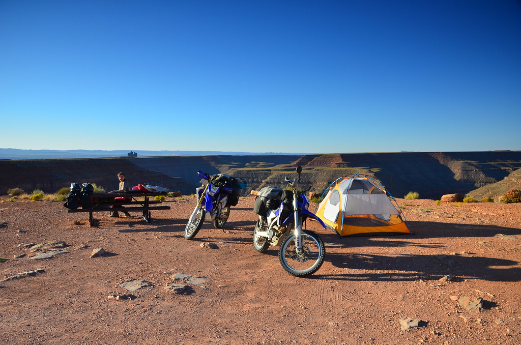
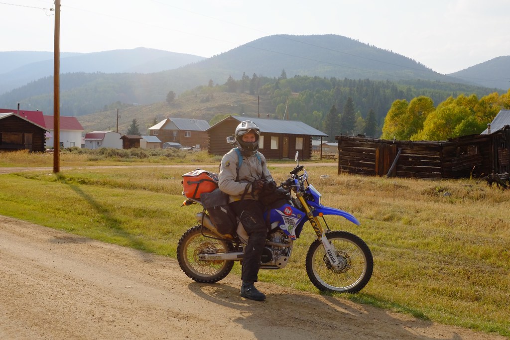
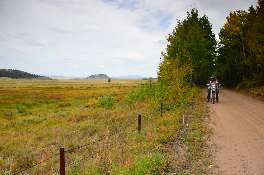
Campsite at the edge of the canyon. There are no barriers or fences anywhere.
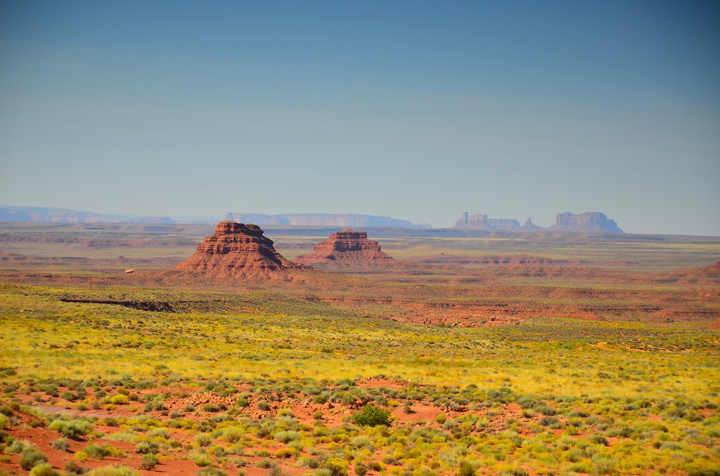
Next, we rode though the Valley of the Gods. It’s a scenic dirt track that passes through landscapes similar to the Monument Valley, but a little smaller in scale. The rocky structures poking out are called buttes and all have romantic names, such as Lady in a Bathtub or Santa and Rudolf. Who do we find here if not the Mexican group from yesterday. They were heading in the opposite direction, picking up a lot of dust.
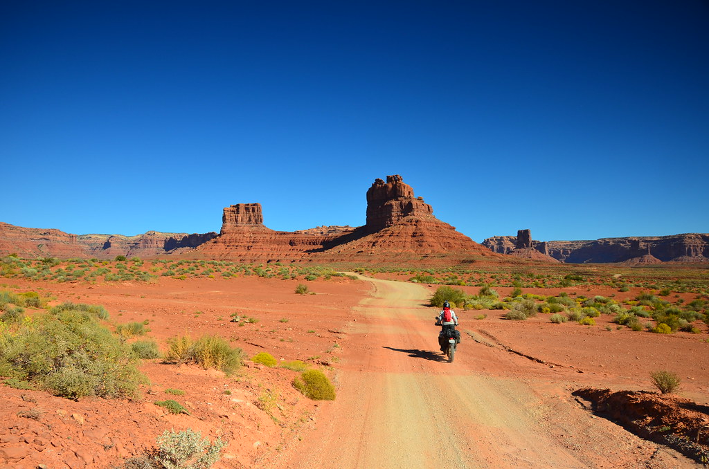
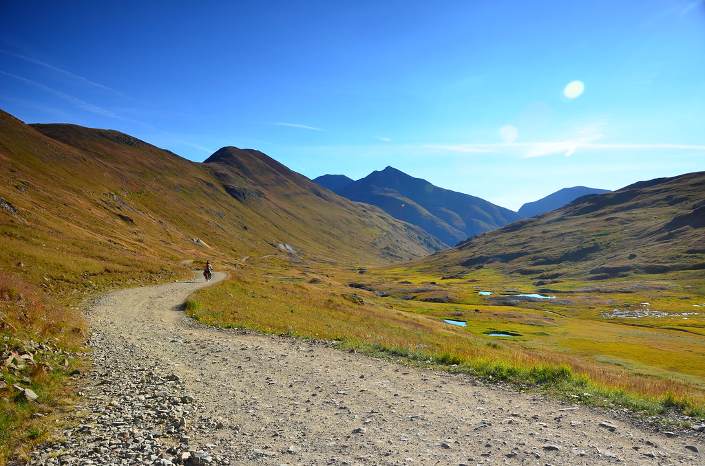
Valley of the Gods
The narrow road and the tall buttes.

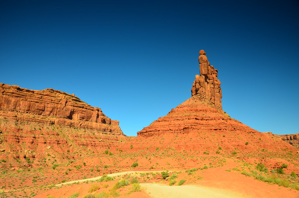
I think that’s Lady in the Bathtub on the left.
Here is the weird bit. If I were magically transported from Toronto into the Valley of the Gods, I would think it was insanely amazing. But having seen what I have seen in the weeks prior, it’s not so much that I did not think it was amazing, but I was more interested in getting breakfast. The constant string of mesmerizing landscapes makes you rather pragmatic, and only in retrospect do you realize that it was really quite special.
The reds and the greens of the majestic valley
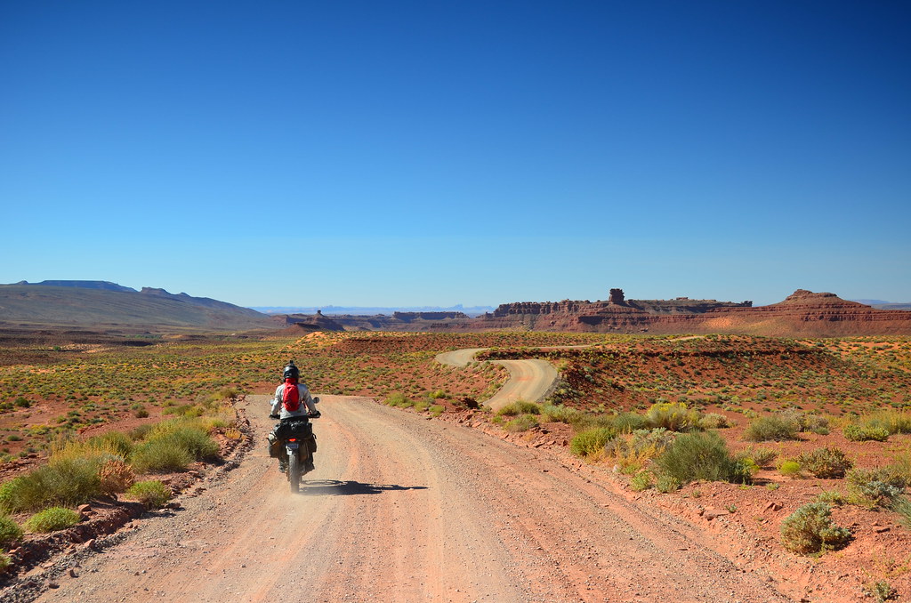
The road meanders a lot. It’s not here to get you to the other side, it’s here to let you enjoy these unique rock formations.

Alex making a friendly gesture
After having breakfast in Mexican Hat we pointed ourselves to a section of Utah Backcountry Discovery Route. Who do we meet there? But of course, two of those same Mexicans. Finally, we decided to properly stop and chat, which they were very eager to do as they were exhausted from riding those trails on their bigger bikes. Apparently, they’ve been exploring the USA for the last 4 years, a few weeks at a time, flying back to Mexico City to live their daily lives at the end of each segment, waiting to return the following year and continue the ride. Eventually they were aiming to reach as far north as Alaska.
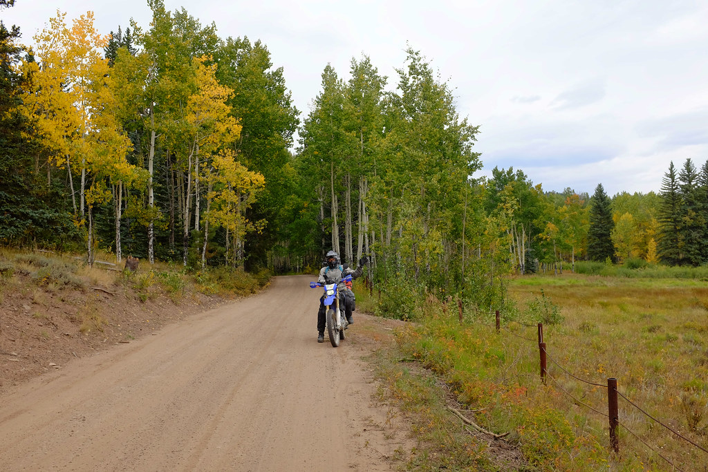
We finished this section of the UBDR with only one instance of me crashing in the sand, and moved on to Colorado. We picked up the Colorado Backcountry Discovery Route near the town of Dolores. It was quite a change of scenery from the red tinted landscapes of Arizona and Utah. The trail was leading through a forest, which seemed a whole lot more like back home in Ontario. Except the elevation was rising, switchback after switchback, reminding us that we were in the Rocky Mountains, not the flatlands of Southern Ontario.
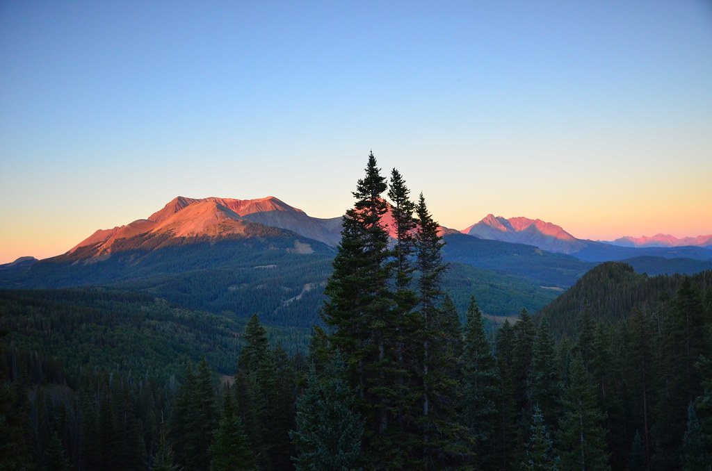
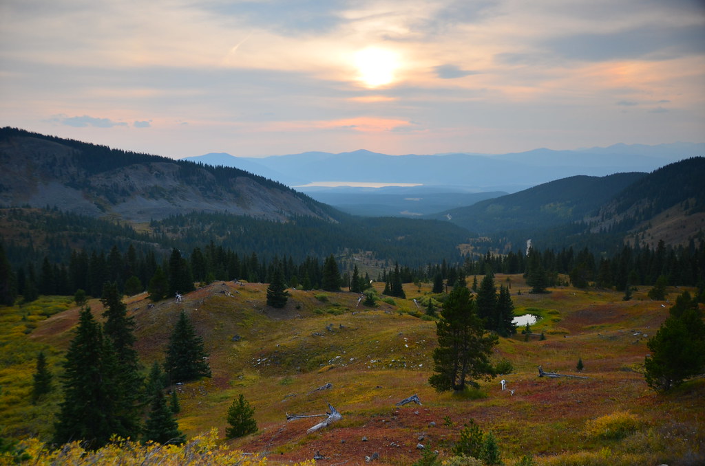
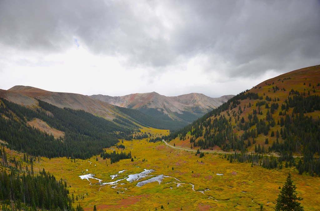
The temperatures were dropping fast as the sun was beginning to set. Finally at the very top of the road, right before the next series of switchbacks was about to take us down the mountain, we saw the perfect campsite, complete with a magnificent view. At 3230 m above sea level, the sky was about to become full of stars.
View from our campsite.
The following morning we rode the rest of the road out of the forest and had breakfast in Telluride. Known primarily for the nearby ski resort, it was very quiet and empty this time of the year.
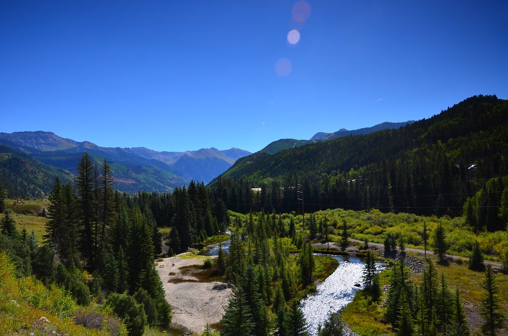
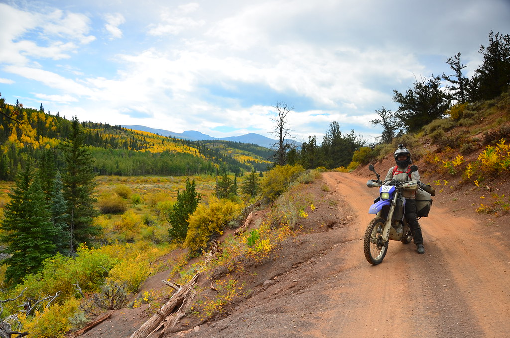
Typical Colorado

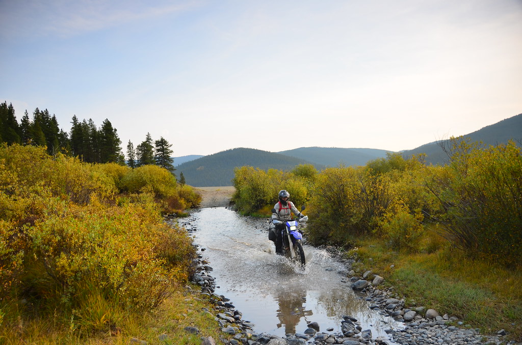
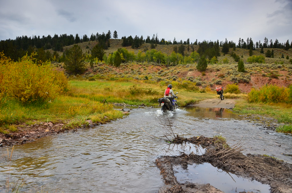
Crossing streams in the Rocky Mountains
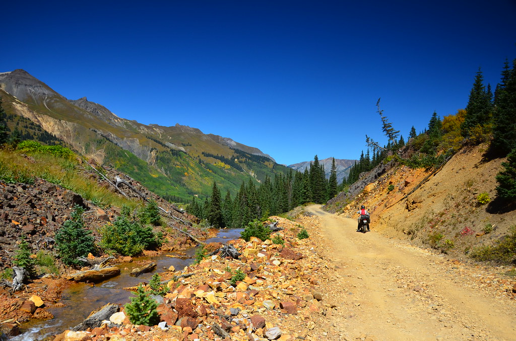
Next up was Ophir pass, a dirt track well known in certain circles. It was not all that complicated for the most part, but had a gnarly uphill segment that was covered in loose rock that got the better of me. After dumping my bike a few times, the last of which had my rear wheel overhanging a sheer drop off, I caved in and let Alex do it. Or rather, he caved in and agreed to do it. It was only about 100 meters worth but it kind of set the mood. It was actually quite beautiful judging by the photos we made, but I do not remember it that way. I just remember thinking way too hard about my riding technique.
Views from Ophir Pass
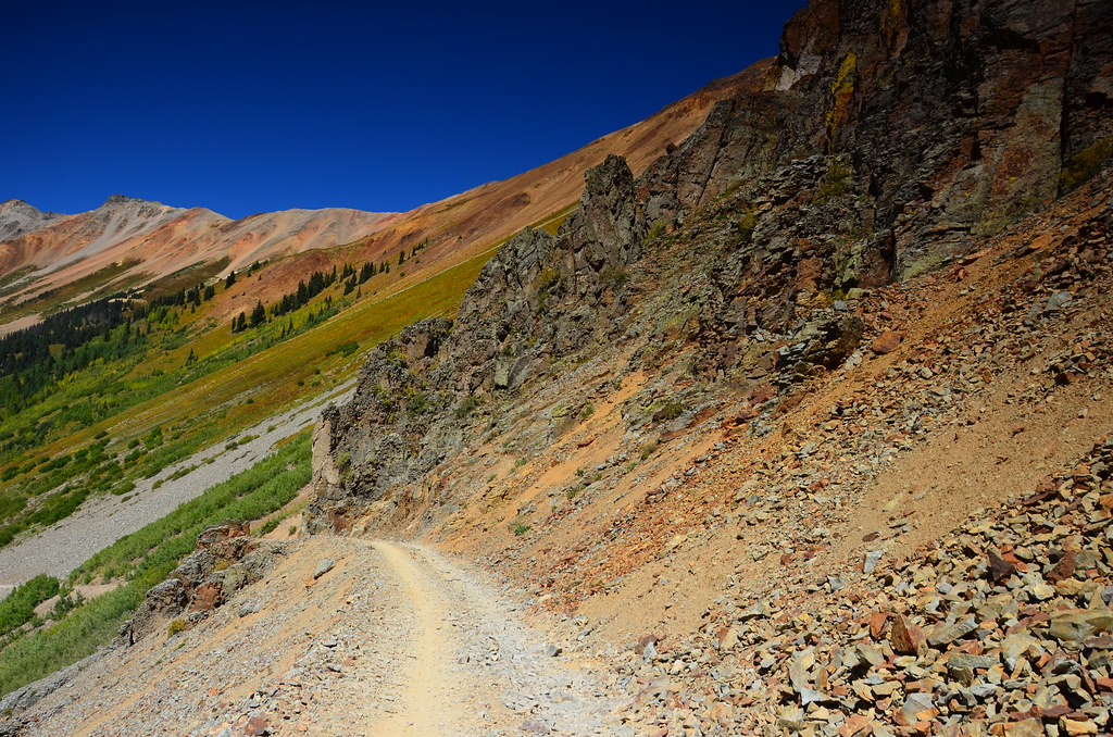
Road towards Ophir pass is getting more and more narrow and exposed
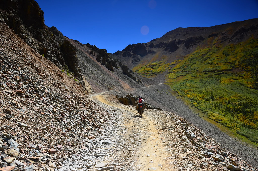
Approaching Ophir pass. This is not the hard part. You’ll have to go there to see the hard part.
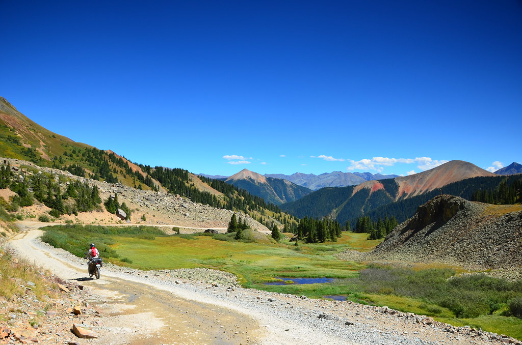
With the hard part over, let’s enjoy the green valleys again.
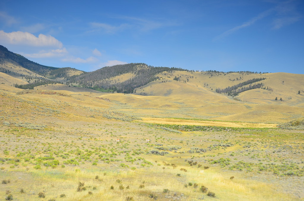
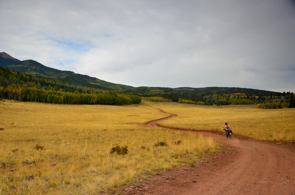
After lunch in the next cute town we headed out again on the CBDR, despite my attempts to suggest a road less beat up. This one was not nearly as bad as Ophir pass, but still, tumbling on rocks (hey, they call them Rocky Mountains for a reason) was not as pleasant as on sand, even at low speeds. We made it about 6-7 miles after an hour of riding, suffering tremendously from embarrassment as we got passed easily by the local kids on dirt bikes and ATVs. We set up camp near a picturesque lake, named Como (no relation). It was 3800 meters above sea level. There were bits of last winter’s snow lingering in the shaded pockets of the mountains. We did not think much of that.
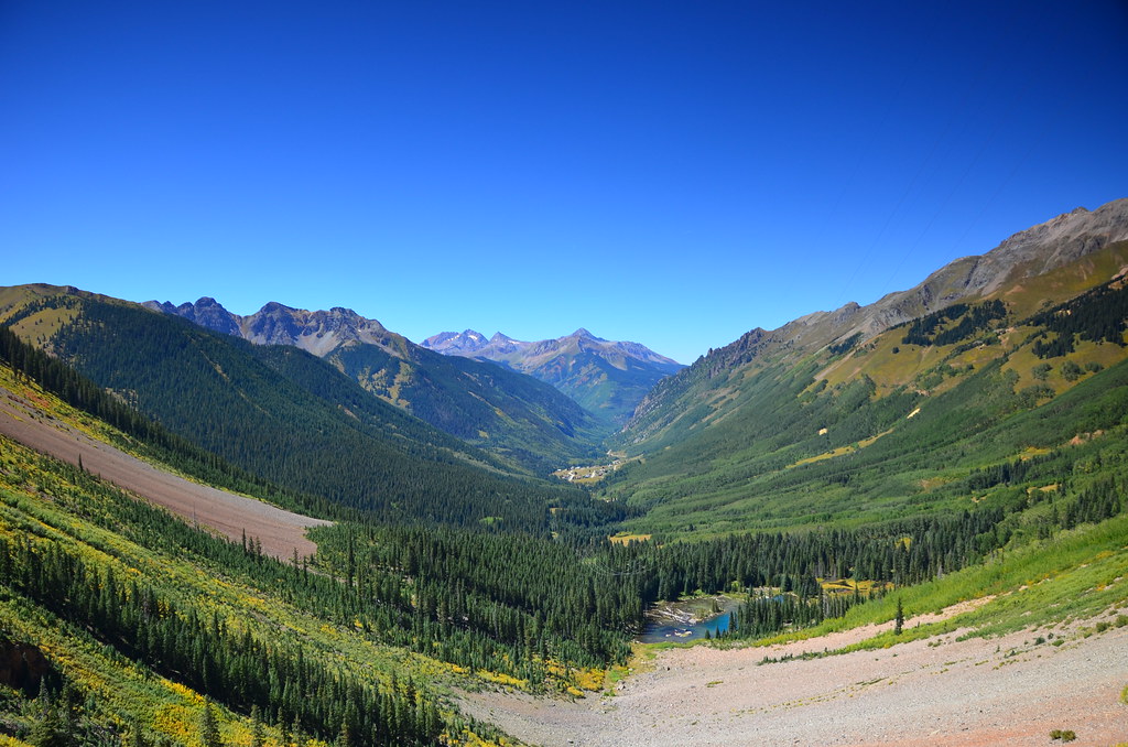
Views near Red Mountain

Mountains all around us.
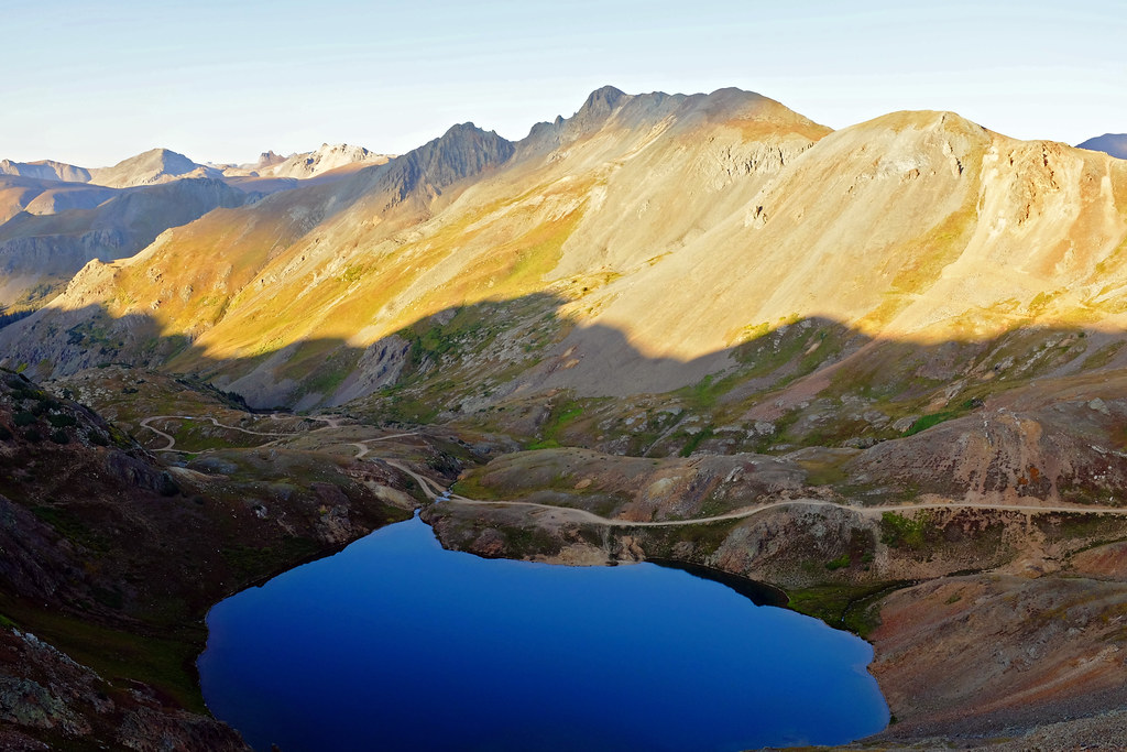
Our campsite nestled within the mountains by the lake.
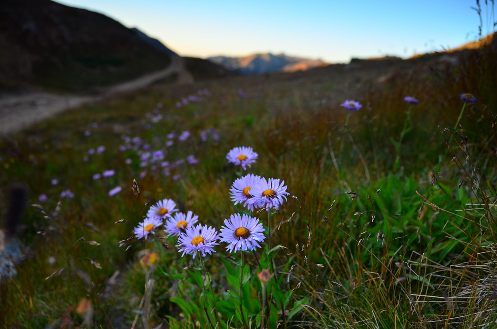
Some of the last flowers of the season, before winter takes over again.

Setting up camp by the quiet lake
View from our campsite
That night we did not get a lot of sleep, due to a variety of factors. First of all, my tumbles in the rocks resulted in large bruises on my thighs that made it difficult to find a comfortable sleeping position. Next, in the middle of the night we heard strange noises and rose up to investigate. It was dark and took us a while to begin to see shapes – shapes that were most likely a pair of pronghorns. But even that was not the biggest distraction. What took the cake was the cold. It was so cold, my head would hurt so much I could not sleep. See, we figured it was still summer and packed only light summer sleeping bags (which don’t have hoods) and did not have any warm gear. Certainly no hats or balaclavas. I ended up wrapping a spare shirt around my head, and shared this life saving tip with Alex. We had a thermometer and it showed +8 °C. I don’t know how that was possible. If I had to guess, I’d say it was close to freezing. With a tiny bit of sleep, we got up and out as soon as the sun returned.
The most challenging trail was actually the one leading from the campsite to the main trail. It was a set of short steep switchbacks going up, and somehow I made it up just fine (i.e. without crashing). I think my bruised thighs just realized that falling again is not an option.
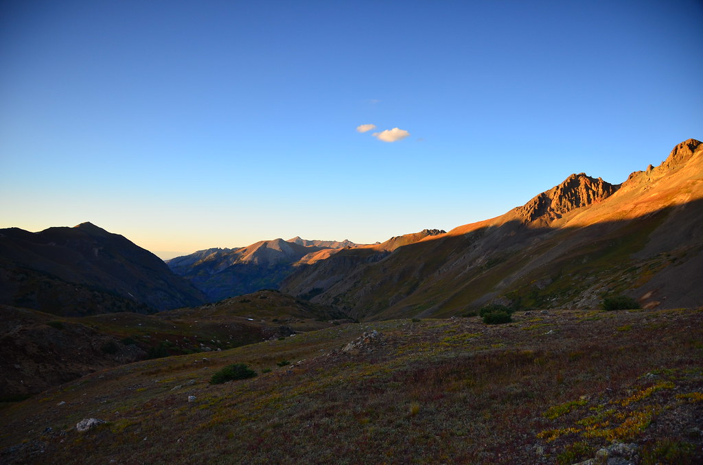
Morning light over the mountains
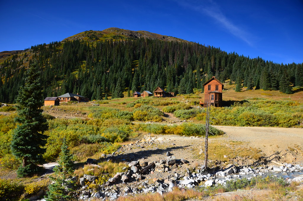
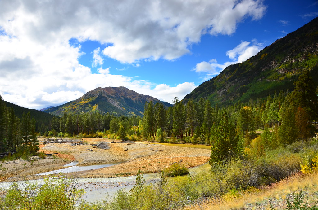
The area used to be a mining hot spot in the 19th century, and there are still many remnants of miners’ equipment and housing in the mountains. Some, like this one near Animas River, are actually well preserved as historical landmarks.

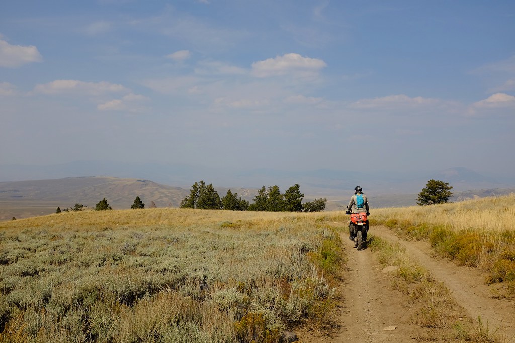
Riding in the wilderness of the Colorado mountains
After that, the remaining route was easy in comparison, eventually turning into a simple hard packed road. It seemed like a miracle really, because we had 140 miles to go to the next town, and the speed of 6 mph the previous afternoon was not very promising. But all in all, it was only 11 am when we rolled in to Lake City for breakfast. We ordered from a much more elaborate lunch menu and were not disappointed. Eat, sleep, ride, anyone? After some deliberations we got back onto the Backcountry Discovery Route, aiming to get to Buena Vista, and stay in a hotel this time. The trails were much easier and we made it to our destination before nightfall.

“I’m gonna go over there and you take a photo. No, I won’t fall into the water.” 😀
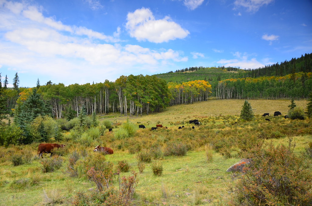
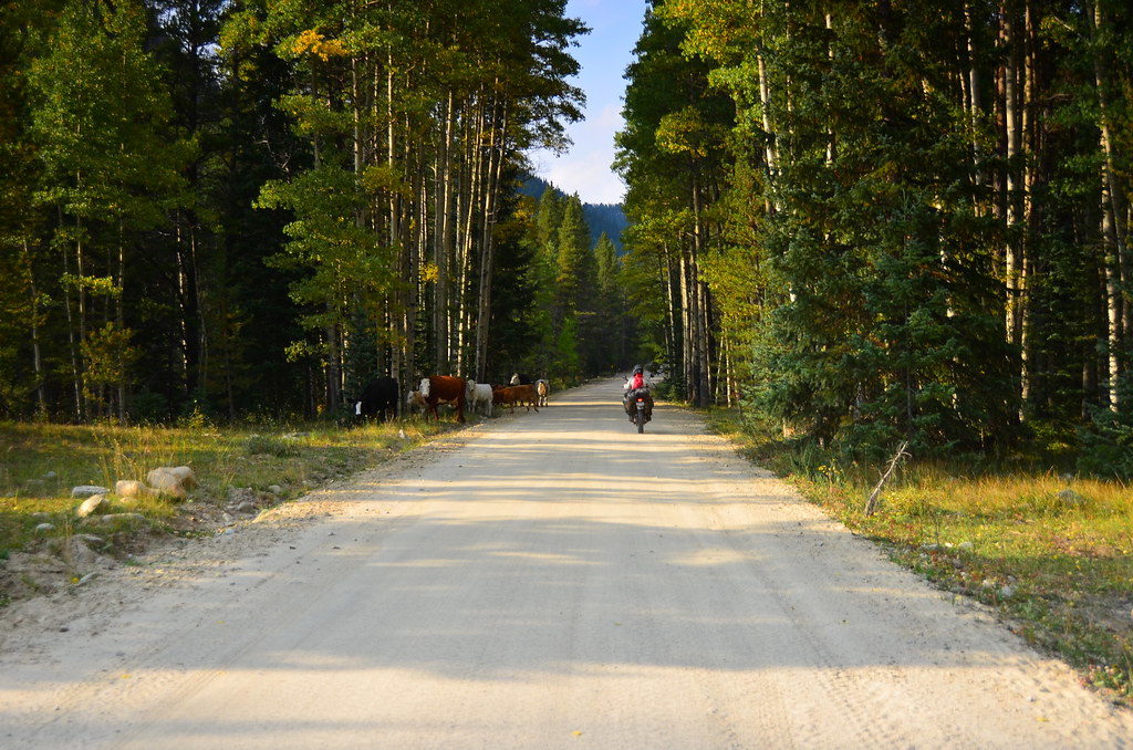
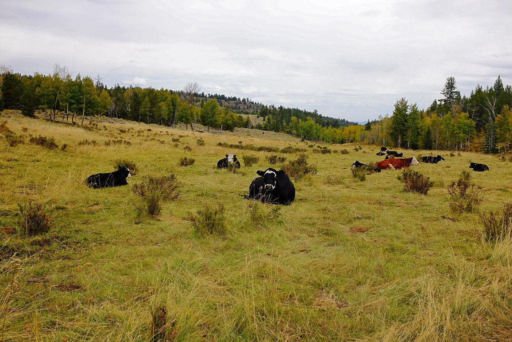
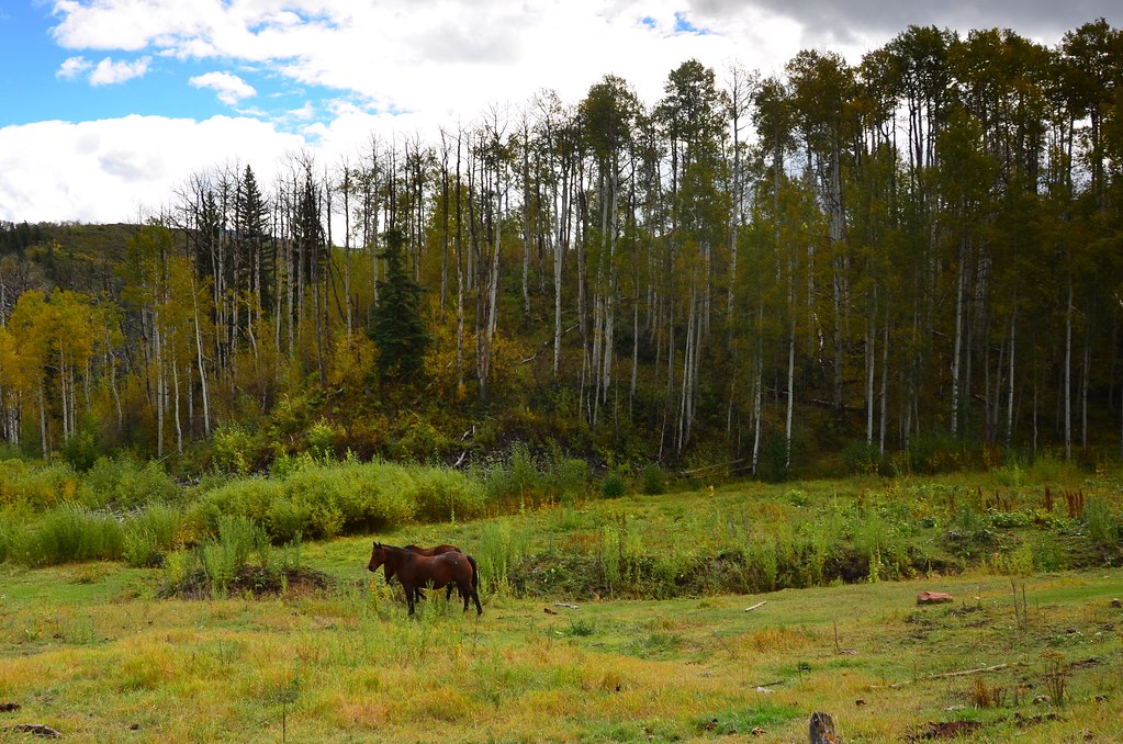
Alpine cows
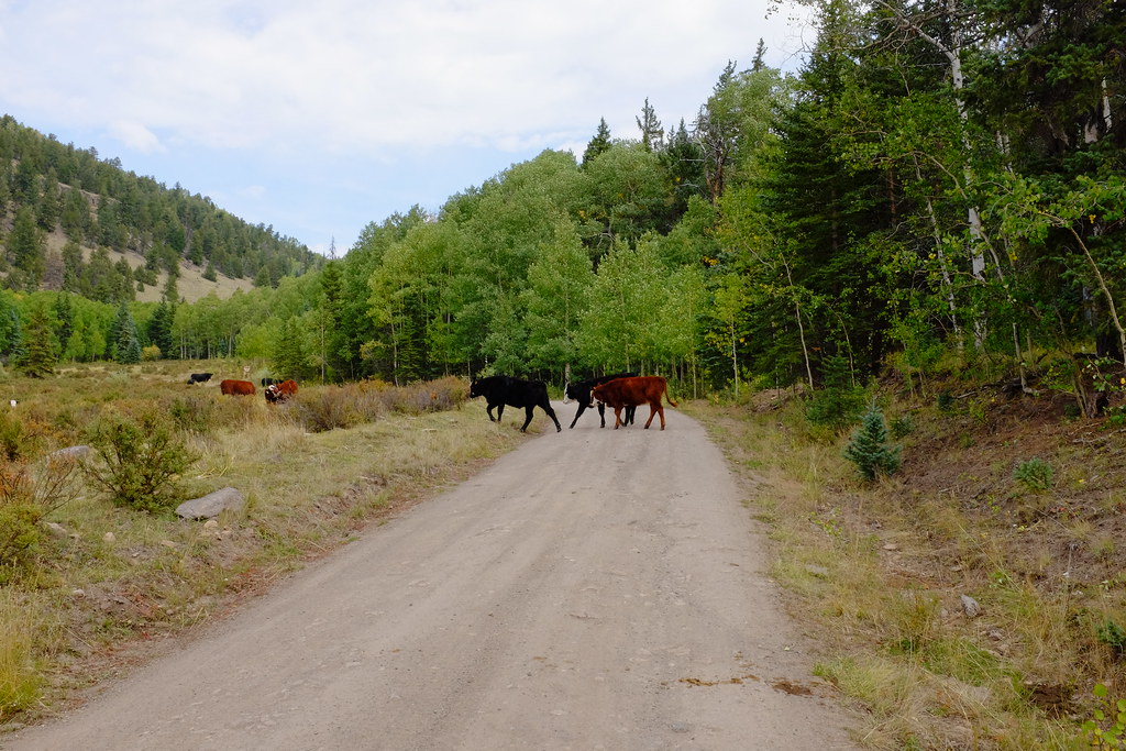
Sometimes they lounge around, sometimes they cross the roads, sometimes they jump down from 2-3 m tall cliffs and continue on like they aren’t cows at all, but graceful antelopes.
A few pronghorns enjoy the expanses of Powderhorn Wilderness.
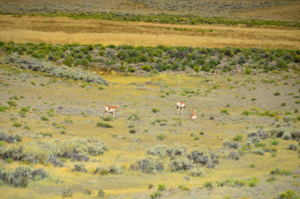
A small herd lounging around.
Cresting a hill to see another valley.
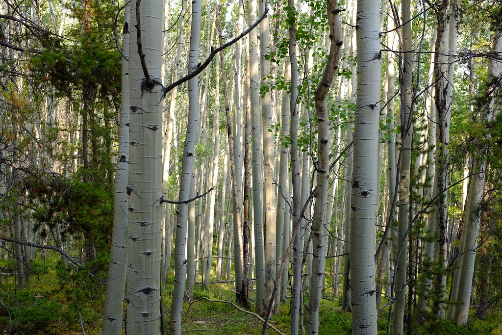
Aspens in Gunnison National Forest
A cute village of Pitkin.
The cows guard the exits and entries into the village.

Riding through Pitkin.
Crossing a flooded section of the road near Sanford Creek.
Views in Gunnison National Forest
Now for the finale, picture this: lavender on a pizza. And it actually worked remarkably well, served with delicious artisanal cream soda. This night we stayed in a surprisingly unique motel. The furniture in the breakfast and lounging areas was made out of river driftwood. One of a kind chairs and tables put a certain sparkle on this otherwise simple Super 8 motel.
The next day was spent covering more mountain passes along the Backcountry Discovery Route. The first section of the day was sandy, but nowhere near as demanding as in Vermillion Cliffs. After that, endless fields, cattle grazing, aspen groves, and even hail and a bit of rain.
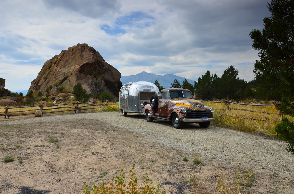
Curious things we found on the way out of Buena Vista
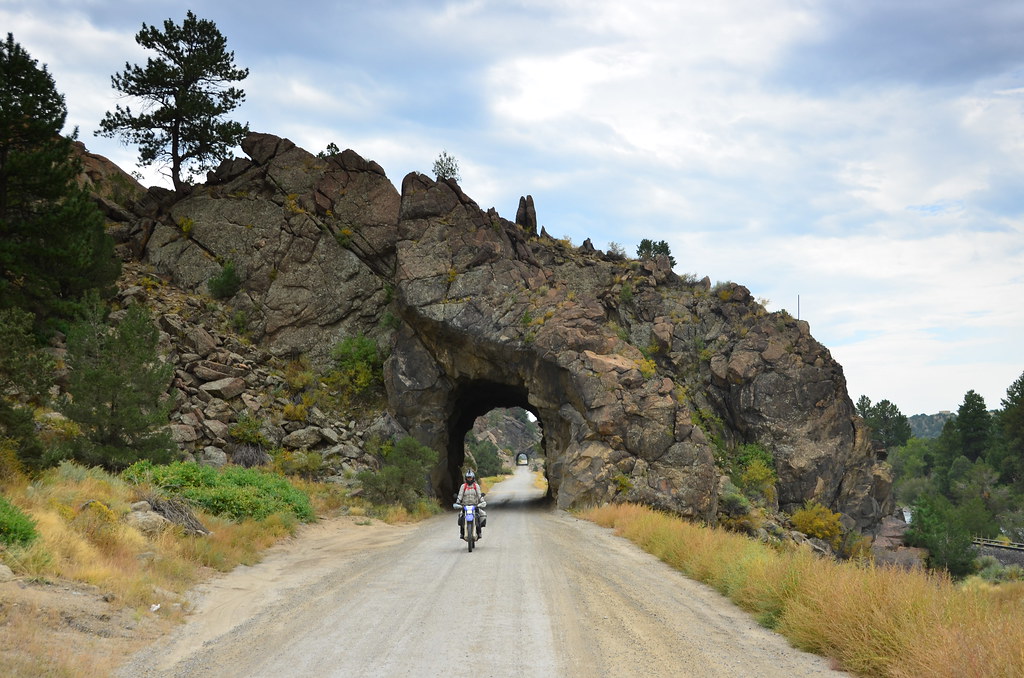
The road out of Buena Vista has about 4-5 of these tunnels with a railroad running alongside. They are short, but very cool.
San Isabel National Forest

The contour of the trail conforms to no easy shape. There is no predicting if it will go up or down or twist on itself.
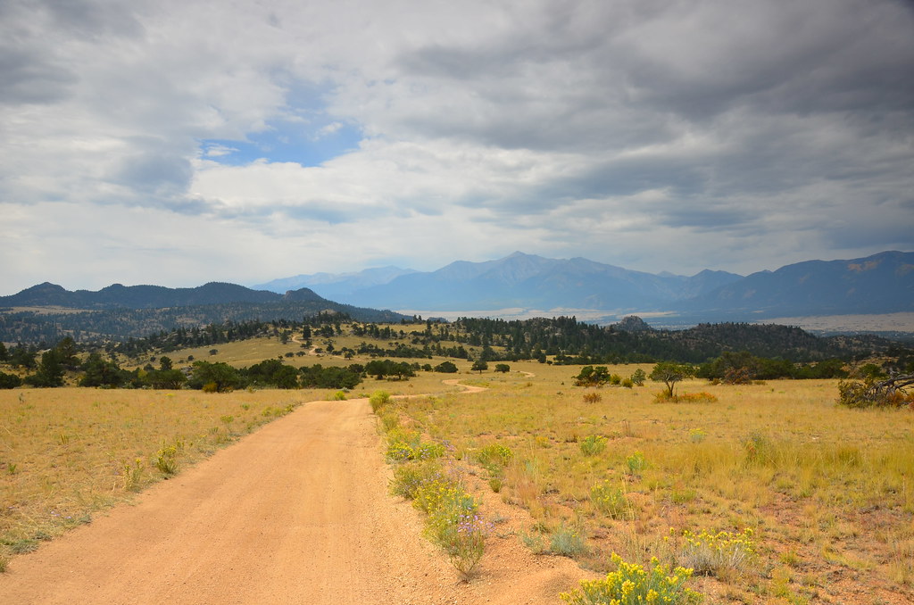
Salt Creek Rd coming out of the national forest
The beautiful aspens are rapidly changing colours
Picturesque trails leading into the woods
Which is where we find more alpine cows!
A creek intersects the road. It’s called Rough and Tumbling Creek. Really.
It is most definitely not summer any more – all the trees in Colorado are welcoming the fall.

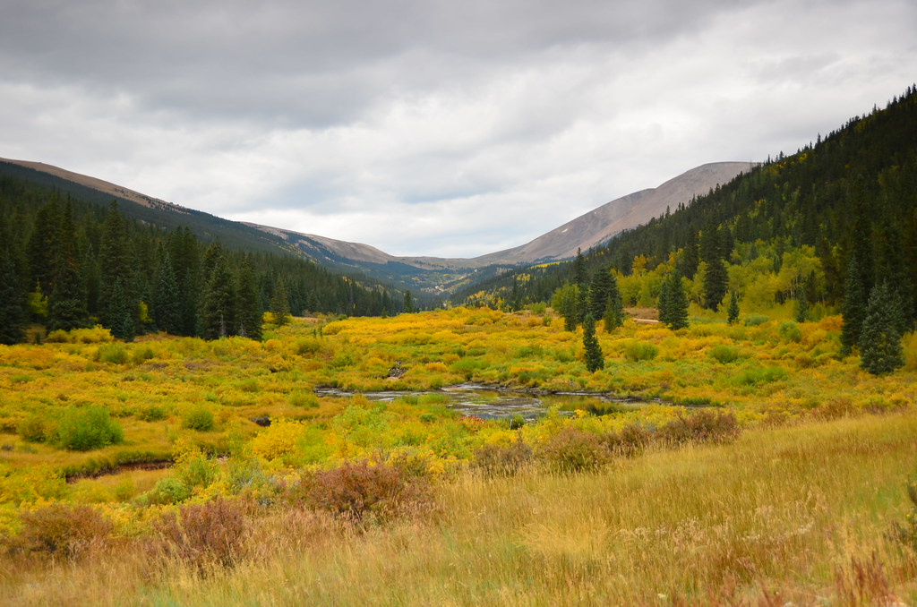
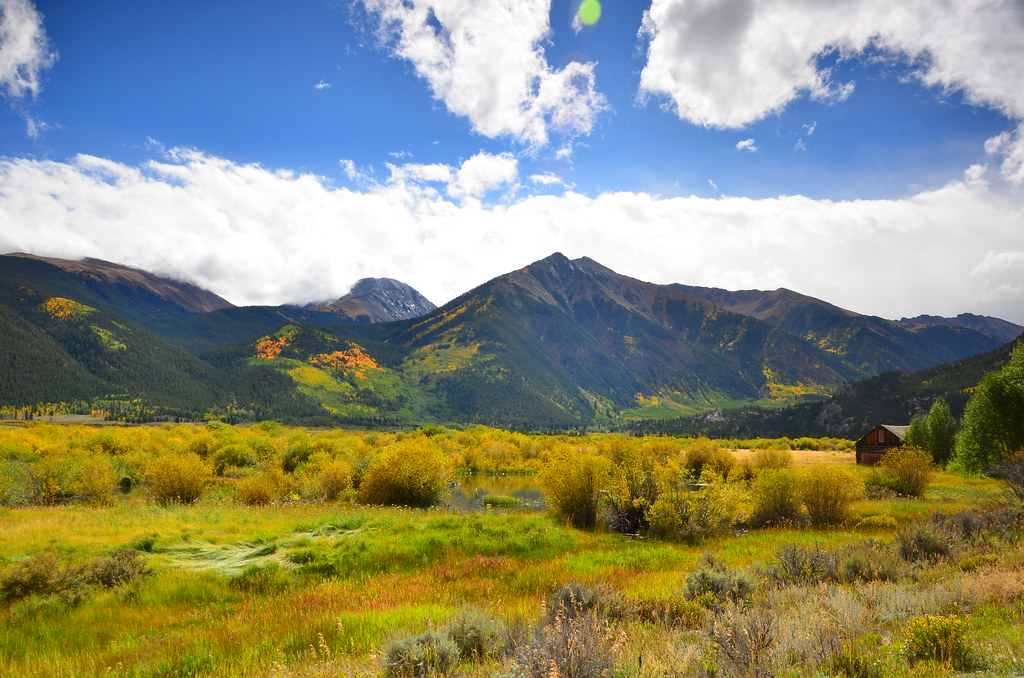
The mountains don’t look so rocky any more, but the vistas are still very enticing.
Many rivers and creeks fill these valleys, allowing for lush vegetation to thrive.
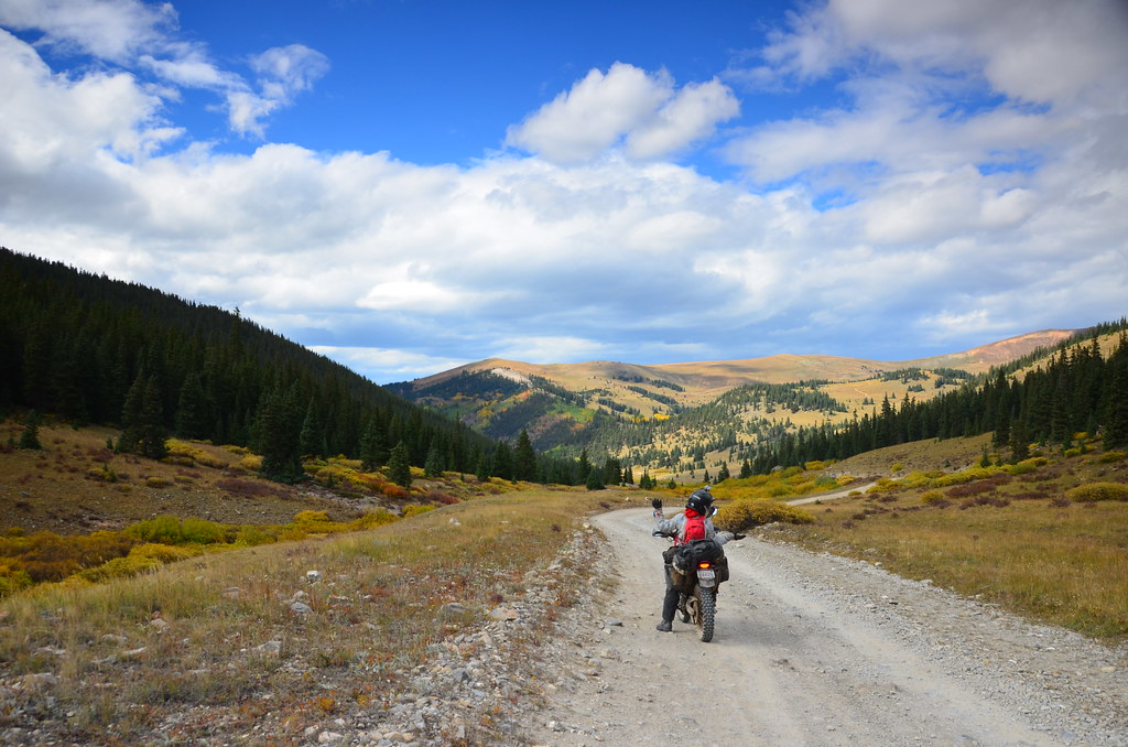
Sometimes you must stop and enjoy the vast expanses of the hills and valleys.
Lunch in Leadville.
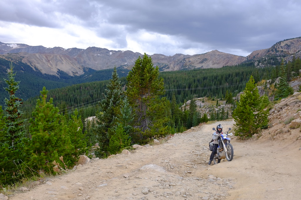
Look at the view! Don’t look at me being stuck on the rough uphill.
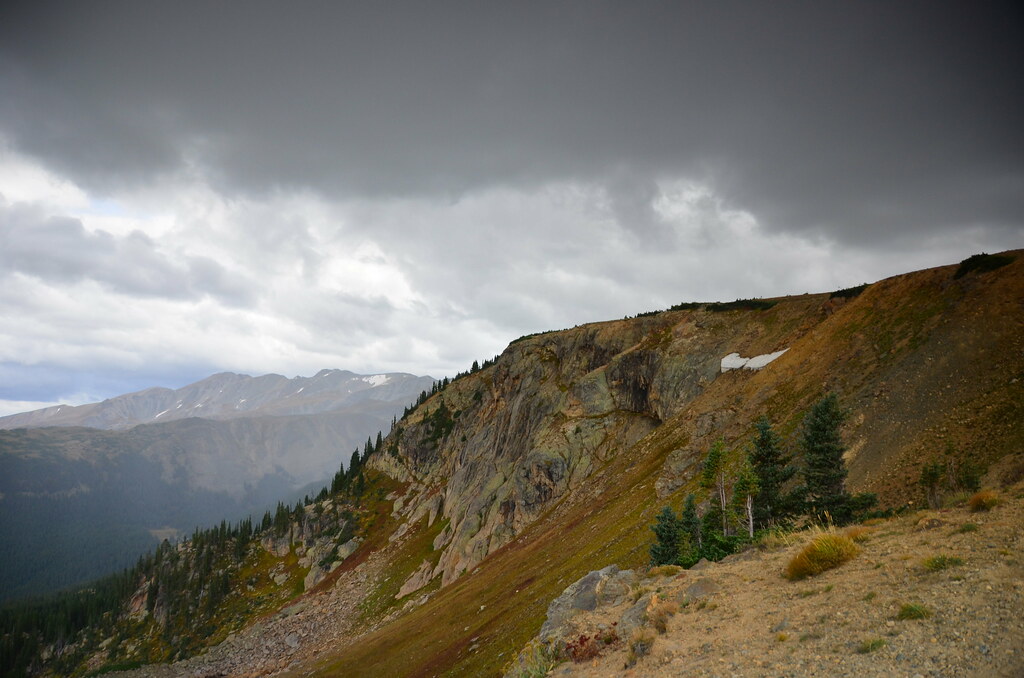
The moody skies promise rain.
We spent a bit too much time at lunch calling the California DMV to make sure we were on track to receive the registration paperwork by the time we had to cross the border, and thankfully, it sounded like there was some hope. The downside was that we actually ran out of light on the trail later that day and traversed the last 20 miles with nothing but our headlights to show the way. Which is better than nothing, but not by much.
Early morning started with a drizzle, which made it very cozy to sleep in while it rained outside. We made more calls to the DMV and planed a route that would takes us over Independence Pass, the beautiful town of Aspen, and Loveland Pass. It kept drizzling on and off, but at the end of Loveland Pass we saw a rainbow, which must have been a good sign.

Rainy morning in Eagle, Colorado
With the rain over, we continue enjoying the local wild and domestic animals.

A sneak peak at Colorado’s real mountains – their snow caps never go away.

Farms and ranchos of Carbondale
Views in White River National Forest, from Top of the Rockies Byway.
Sunny skies make the mountains so much more friendly
Magnificent views near Twin Lakes Reservoir.

Descending from Loveland Pass.
We have crossed all of Rocky Mountains, ending up in Denver. It’s all flat from here on.
No Comments »
No comments yet.